Long Bredy, The Cleaning of Bones

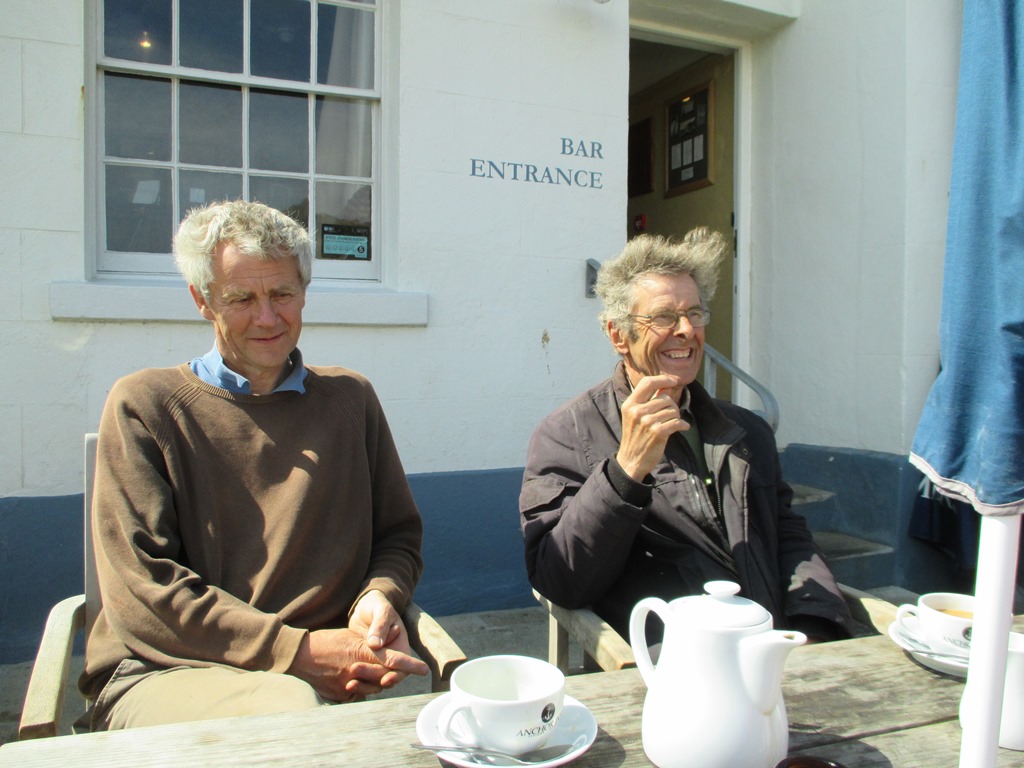
This week: the LiDAR survey report for the Stourhead Estate was completed; at Chedworth we understood the drains; a meeting at Brean Down gave context to a 65,000 year old horse’s tooth, and, on the northernmost edge of the South West Region… geophysics has begun to provide evidence for the origins of Hidcote.

Wonderful stuff.. and all for future consideration, but my heart is still at Long Bredy and our recent excavations there.

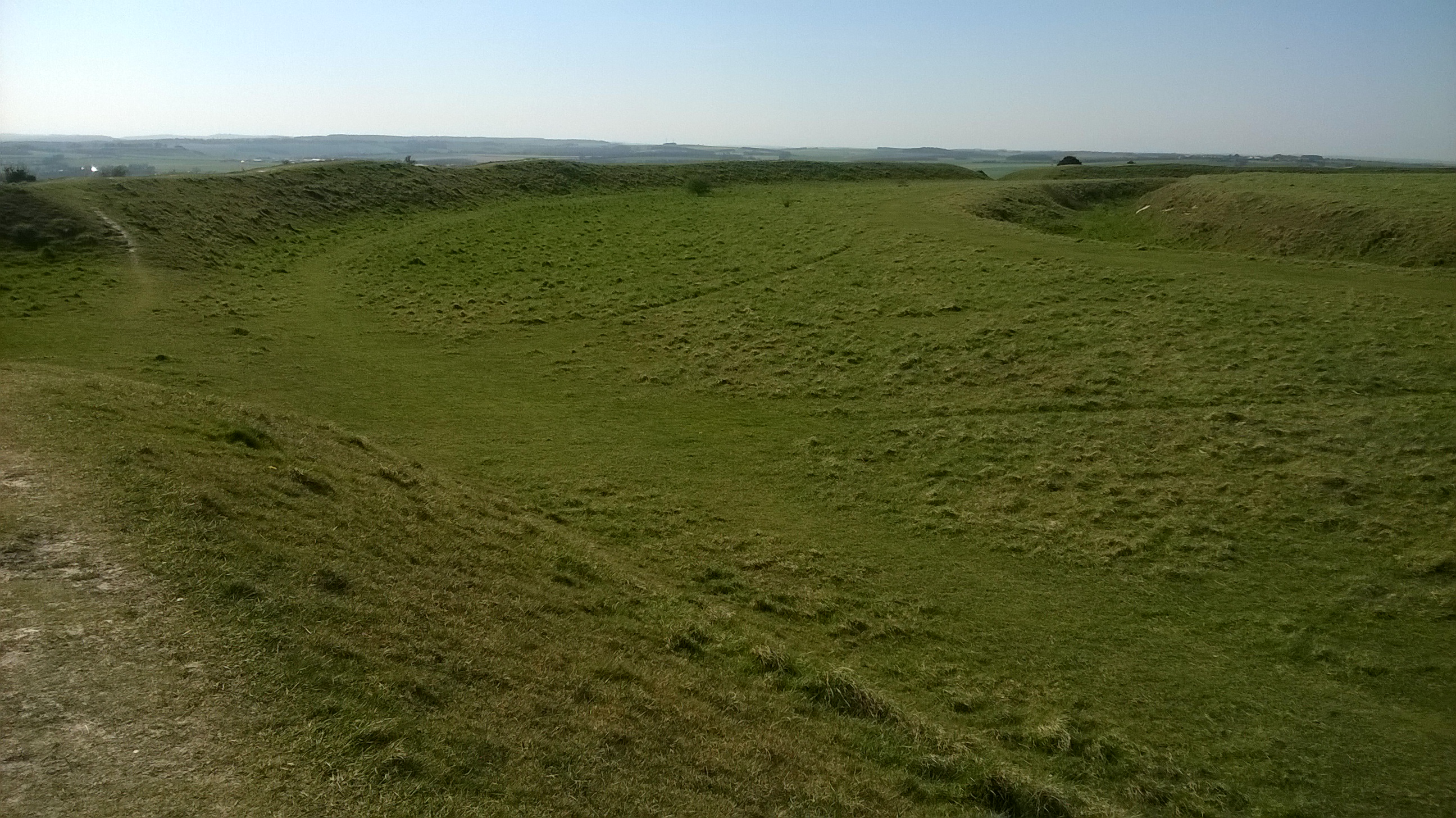
I walk on past the parish church, and up, steeply, through the pasture field to the Ridgeway’s western edge. The sheep watch the figure follow the spine of Martins Down bank barrow. Stopping to enjoy the wide fading landscape, out across Golden Cap to Start Point. Then back through a field of ripening wheat and down a deep grassy hollow-way, back past the church to my tent. Everything glowing red in the setting sun, every strand of grass richly pink and the wool strands hanging sharply in the wire.

Looking towards Long Bredy church from the hollow-way

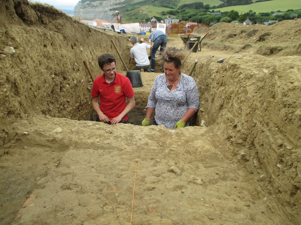
One day, when it seemed that we would run out of time. A long day of mattocking, barrowing.. collecting fragments of flint and small sherds of red-black pot. Level after level of 5cm spits of soil. I came back to continue on into the evening and Rob said he would too …but the energy was gone… we exchanged glances and eventually stopped, limply putting the tools away.

The cluster of large stones overlying the burials cut by the 2013 pipeline

The next morning, the lumpy surface turned into a cluster of large stones and we began to carefully lift them one by one. Each stone covered human remains, broken and impacted by their weight over the millennia. Three crushed skulls and a jumble of long bones.Yellow and fragile mixed with soil and roots. The roots looking like bones and intermingled with them. A trowel, a plastic spatula, a pair of secateurs and a fine brush.

A view of the three skeletons looking north

Then the cleaning of bones. A long quiet day, crouched in a trench in a field. Nothing else, just the gentle loosening of soil around them. The initial shock and concern.. then yielding to beauty. The realisation of practical creative design, every curve and facet. A broken pair of shins is exposed; delicate, hard and finely formed. You stroke your own, feel the tibia below the warm skin. Then the softer bones of the feet, a jumble of tarsals. Extraordinary heel bones and the wonder of toes.

The northern teenager with feet and legs bent above the head.

We brought back the bones, gathered from the 2013 pipe trench. We took away a few small fragments for DNA and strontium isotope analysis. Once we had cleaned them, Clare came and analysed the skeletons. Two teenagers, one with head to north and one with head to south. One tightly bound and face down, one doubled with feet above the head and the third, a young adult, crouched, the last to be buried. Most of this one gone after the JCB struck six years ago.

A dry fortnight ..but as we packed up it started to rain.. though by that time Nancy had protected the skeletons. Carefully covered, then placed them under a blanket of sieved soil. The stones were put back in place and then Clive brought the digger and pushed the spoil back over the trench. The flint and chert flakes and tools, the pottery and the animal fragments together with the samples from these three 2700-2800 year old people will all tell more of the story.

We will wait, and in the mean time…

I will appreciate the intricacies of my feet.


The Wessex Hillforts & Habitats Project

Early morning last week…a drone took off over Hambledon after light snow. Perfect conditions, the snowflakes had settled into the valleys of the great encircling hillfort ditches… and streets of round house platforms became visible as rows of hollows outlined in white.

Hambledon Hill light snow shows the dimples where Iron Age round houses once stood.

These photos help illustrate the majesty and awe of this vast archaeological site and has helped us launch the National Trust’s Wessex Hillforts and Habitats project. With the help of Marie, our project officer, the People’s Postcode Lottery have granted over 100,000 pounds to get the project started.

The primary purpose of the project is to enhance the conservation of 13 NT Iron Age hillforts scattered across Dorset and South Wiltshire …but it will also inspire people to get involved and to carry out monitoring and research. It will also create new interpretation to bring these grassy hill top earthworks to life as places to be appreciated, valued and better understood. Alongside this.. to highlight nature, particularly the plant and insect life. Each hillfort’s unique topography nurtures precious habitat undisturbed by agriculture for over 2000 years.

Purple spotted orchids growing on the sheltered slopes of a hillfort ditch

So.. where are these places. I’ll list them out for you…. and as some have featured in previous blog posts I’ll reference these while we have a quick tour.

We’ll start in Wiltshire and from there head south and west and eventually end at the Devon border.

Figsbury Ring, north-east of Salisbury. A circular rampart and ditch with a view back to the great cathedral spire. Strangely, Figsbury has a wide deep ditch within the hillfort ..potentially Neolithic but there is no rampart.. where did all the chalk go?

Figsbury Ring from its rampart top showing the wide deep ditch inside the hillfort.

South of Salisbury, Wick Ball Camp above Philipps House, Dinton.. NT only owns the outer rampart.

Then there is the icon of Warminster, Cley Hill (blog posts “Upon Cley Hill’; Upon Cley Hill 2”), a flying saucer shaped chalk outlier with two round barrows on the summit..a strange hillfort.

To the south west, at the source of the mighty River Stour, is the Stourhead Estate with its two hillforts. These are Park Hill Camp, its views hidden by conifer plantation and Whitesheet Hill  (blog Whitesheet Hill Open at the Close) with wide prospects across the Blackmore Vale towards Hambledon and Hod. We’ll follow the Stour to reach them.

Hod is the largest true hillfort in Dorset, the geophysics has shown it full of round houses…a proto town… and there are the clear earthworks of the Roman 1st century fort in Hod’s north-west corner (blog post Hod Hill Camp Bastion)

Hambledon is close by, just across a dry valley, perched high on a ridge, surrounded by the Neolithic, you feel like you’re flying when standing there. (blog post Archaeology SW day 2014, Hambledon Sunset)

Follow the Stour further south and you reach the triple ramparts and ditches of Badbury Rings on the Kingston Lacy Estate. From here you can see the chalk cliffs of the Isle of Wight (blog post Badbury and the Devil’s footprint)

Now from Badbury take the Roman road west to Dorchester and keep going beyond the county town, glancing at Maiden Castle as you pass(Duchy of Cornwall, English Heritage).

The Roman road continues straight towards Bridport but branches from the A35 road before you reach the village of Winterbourne Abbas.

It has now become a minor road.. a couple of miles on… it branches again..still straight but this once arterial Roman route to Exeter has dwindled to a narrow trackway with grass sprouting from the tarmac.

Don’t lose heart…keep going…and you will break out onto the chalkland edge and the multiple ramparts of Eggardon Hill.

From Eggardon, the other hillforts emerge as sentinals ringing the high ground overlooking the Marshwood Vale, and, to the south, the cliffs of Golden Cap.. and beyond, the sweep of Lyme Bay and the English Channel.

Winter woods at Coney’s Castle

Next to the west is Lewesdon Hill, a small fort but occupying the highest land in Dorset, nearby is the second highest, the flat top of Pilsdon Pen, surrounded by double ramparts and enclosing Iron Age round houses, Bronze Age round barrows and the pillow mounds of  the medieval rabbit warren.

The last two in the Project guard a gap through the Upper Greensand ridge at the Devon border. Coney’s Castle has a minor road running through it and on its south side are wonderful twisted moss covered oaks… and beneath them the deep blue of bluebells in the Spring. Lambert’s Castle was used as a fair up to the mid 20th century, remains of the fair house and animal pens can be seen there ….but once again the views are spectacular, particularly in early morning after frost with the mist rising from the lowland.

Lambert’ s Castle after frost.

A baker’s dozen of hillforts of the 59 the NT looks after in the South West.

One might imagine that these huge works of humanity look after themselves… but they need to be cared for.. we must have farmers willing to graze the right number and type of stock on them….at the right times;  NT rangers and volunteers to cut regenerating scrub and fix fencing and gates…

If not, these nationally important scheduled monuments and SSSIs will deteriorate. The earthworks will become overgrown and grassland habitat will be lost, archaeological knowledge locked in the layers beneath the soil will become disrupted… and the views into the landscape and across and within the hillforts will become hidden.

The Wessex Hillforts and Habitats Project promises to be an exciting time of conservation and discovery. The work has now begun!

Sounds of the past

View Eastwards from Golden Cap, Portland in the distance

We have worked with a few art projects over the years, involving objects, processes and site specific projects. One I remember fondly was ’26 and 7 Bones’ in 2012  A contemporary arts project about hands and feet, people and place –  a mapping of connections across place and time – an action, a journey, a collection – and was commissioned as part of the Jurassic Coast Earth Festival 2012, with artists Sue Plamer and Sally Watkins  https://26and7bones.wordpress.com/

We had excavated quite a few sites along the West Dorset coast so Sally and Sue asked if they could work with us, to join the coastguard, blacksmith, herbalist and ornithologist already recruited. Part of the project involved walking up Golden Cap,  talking along the way about what we do as archaeologists and how we feel when working on a site. We had excavated the Bronze Age Barrows and Napoleonic signal station right on the top of the hill over a couple of seasons, with an amazing view as we worked. It was hard to remember that the Bronze Age people would not have had the same view, as the coastline would have been about a mile further out to sea.

As part of the project we were asked to choose a favourite word or place associated with what we did along the coast of Dorset. I chose the word prehistoric, as West Dorset, to me, feels prehistoric, with its hill forts, barrows and stone age objects eroding from the cliffs. It was then turned into music, by punching holes into card in the shape of the word and then fed through a musical box mechanism, a magic moment!


Quern quest

Looking east from Seatown, West Dorset

Looking east from Seatown, West Dorset

As Martin so eloquently puts it ‘the cliffs are leaking archaeology’ especially in West Dorset, with its soft geology and erosion by the sea. Luckily for us there are keen-eyed locals who walk the same routes and notice changes and strange objects laying on the beach or sticking out of a fresh landslip.

A few weeks ago I found a message on my desk to ring a Mr Bickford who had found what he was sure were parts of a quern stone used for grinding corn and some clay loom weights, near Seatown in West Dorset. I felt a little jolt of excitement, as regular readers of this blog will recognize Seatown as the place where we excavated a Bronze Age burnt mound and two Iron Age ovens. (see 20/07/2015 burnt mound the story so far). Could we have more evidence to fill out the story of the Iron Age at this site, or was this a new place to investigate further along the cliff?

The layer of burnt flint and stone can be seen in the middle of the picture

The layer of burnt flint and stone of the ‘burnt mound’ can be seen in the middle of the picture

I rang and arranged to pop over to Seatown and look at what he had found and record were they came from. So it was that I headed west on a bright and sunny morning, deep blue sky above and spirits high. I was not disappointed!

I met Humphrey in the car park and we walked up the hill to his house, round the corner and into the garden. What I saw took the last of the breath away that the climb up the hill had left me. On the garden table were three large pieces of quern, both upper and lower stones, and next to them what looked like one and a half very large triangular clay loom weights!

“Wow! Oh yes they are exactly what you thought they were”

The top and bottom stones together as used

The top and bottom stones together as used

The pieces of quern stone

The pieces of quern stone


The stone the quern is made from is not local to the immediate area. We have had a few geologists look at images and one suggestion is that it may be continental! But they need to see it in the flesh, so to speak, so they can see every mineral and inclusion.

The loom weights are very large and have more holes than necessary so may not be loom weights. If they were they would have been used on a warp weighted loom, to make cloth by keeping tension on the warp(fixed thread)

The loom weights

The loom weights? probably something else but what? 

Hopefully my hand gives a scale to the size of the weights

My hand gives a scale to the size of the weights

Both the quern and the possible loom weights are probably Iron Age and the small piece of pottery found with them looks very like the Iron Age pottery from the ovens found when excavating the ‘burnt mound’ site nearby.

A reconstruction of a warp weighted loom, the weights are along the bottom behind the lowest bar

A reconstruction of a warp weighted loom, the weights are along the bottom behind the lowest bar

A roman hand quern very similar technique to an iron age quern

A Roman hand quern, using a very similar technique to an Iron Age quern


Once again we are on the trail of more information about a site. Try to solve the mystery of the weights and it’s a trip to the geologist first to see if we can track down the origin of the quern stone, who knows what stories we can then tell about the people who lived at Seatown over two thousand years ago.

Day twelve – end of the section line


 Clive and his digger arrive on site

Clive and his digger arrive on site

The final day, nose to the grind stone, no tea break and a late lunch.

Martin cracked on with the last of the drawing and recording, Carol and Millie finished digging the eastern end. I attacked the possible second kiln/oven and finished revealing the opening of the first one. Rob and Fay went for the natural bedrock in their trenches, with help from Clive and his digger 🙂

Looking west along the trench Carol working in the eastern end and Martin recording the section


Martin recording the extra information uncovered in the eastern end of the trench

Martin recording the extra information uncovered in the eastern end of the trench


Due to the efforts of all the diggers Clive only needed to do one scoop to hit the bottom of the burnt mound material, the thin buried soil it was sat on and he top of the natural bedrock. The layer under the mound was very pale grey and silty. We took a sample of this to look for pollen and to look at the soil make up, one of many samples taken through the mound.

The small scoop taken out by the digger after Fay had cleaned it up, so we could see the layers better

The small scoop taken out by the digger after Fay had cleaned it up, so we could see the layers better

IMG_0861

The kiln/oven finally gave up its form, the charcoal spread out of the opening. The second kiln/oven had a layer of burnt clay but no charcoal under that layer, just a brown soil, but one side of the opening was very clear to see. Both had an opening facing the same way, west-south-west.

The kilns/ovens side by side

The kilns/ovens side by side

The charcoal was very well preserved as I found earlier. It’s amazing that the structure of the wood is locked by burning and we will be able to see what species it was thousands of years later.

Well preserved charcoal

Well preserved charcoal

Then the sad moment came for Clive to start filling in the trench, and time for us to eat a sandwich, re-hydrate and have some Women’s Institute lemon drizzle cake provided by Fay. Yummy!

Clive starts the back filling

Clive starts the back filling

We had one last task to do, with Clive happy to help we just dug out the area next to the kiln/oven to see if we had another one to the inland side, alas we didn’t but it was worth a look as we would always have wondered.

The last few scrapes

The last few scrapes

With one last look at the cliff edge that had been our ‘office’ for two weeks we headed down to pack up the tools and then for a well earned cuppa.

Martin and Rob reflecting on the last two weeks

Martin and Rob reflecting on the last two weeks

We will post updates about all the samples we took and the radiocarbon dates as we get them back from the specialists. The pottery and flints need washing before we send them for identification and dating. So keep watching the blog.

NEWS – The next dig will be Chedworth Roman Villa, from 18th August, see you there 🙂

Day eleven – it always happens…..

Sorry for the delay in updates. It seems to be the law in archaeology that features appear at the last moment, and time moves so quickly on the last few days!

We had lots of visitors today, the school came back to do some post excavation finds washing and colleagues from our team came to visit and to help. Stephen, one of our curators, was soon mattocking and Mike our gardens advisor was chief bucket emptier along with our line manager Wendy.

 Our team from the National Trust came to visit and help on site

Our team from the National Trust came to visit and help on site, Stephen wielding the mattock

Due to the time constraints it was time to reduce the trench size again and target the areas we needed answers from. The eastern end of the mound was not behaving so we need to find where it ended and if the stoney area was related to the mound or something else altogether.

Millie and Carol were giving the mission to sort out the eastern end

Millie and Carol were giving the mission to sort out the eastern end

Meanwhile down at the western end of the trench Rob was finding a ditch cutting through the end of the mound!

The ditch appearing with the black mound materiel on the right and left edge of the picture

The ditch appearing with the black mound material on the right edge of the smaller trench


Martin recording the ditch with help from Rob who dug it

Martin recording the ditch with help from Rob who dug it

The mound keeps going down, but has now got small patches of clay within it; hopefully not far to go now until we find the bottom of it.

The black mound

The black mound

This was the day the kiln/hearth/oven would reveal it’s flue/opening, or was it! As I worked to remove more of the red burnt clay (possibly the collapsed walls of the feature) I found the edge of a piece of pottery. It looked like it may be sat under a lump of clay that may have been one side of the opening of the kiln/hearth/oven.

 The edge of a  large sherd of pottery

The edge of a large sherd of pottery

As I dug it got bigger, and bigger.

The pottery got bigger!

The pottery got bigger!

Then it was time to remove the clay that seemed to be filling it.

The clay lump removed

The pottery fully exposed

Sadly it was cracked and small roots had grown through the cracks. As each piece came out we realized it was a base of a pot.

A lovely base

A lovely base

Phew! What a day. We stayed late to get as much done as we could, Martin had been recording and drawing the sections, while we all concentrated on our own small areas of the site. We left for a well-earned end of dig pizza, and a refreshing brew, hoping that in the last day we could manage to finish before Clive back-filled the site, and the porta- cabin disappeared!

Day ten – into the black


Alex and Fay in a hole!

Alex and Fay in a hole!

Time to tackle the mound material and the oven/kiln/hearth. With three days left we need to get as much information from the site as we can.

Ali, Alice and Carol carried on revealing a packed stone layer next to the mound layers in the east end of the site, Fay and Alex started to mattock out the mound layer to the west of the hearth/oven/kiln. Martin and Simon moved further west to find the edge of the mound. I was given the job of digging the kiln/oven/hearth.

Alex taking a level before bagging up a sample of  the mound material

Alex taking a level before bagging up a sample of the mound material

The black mound material

The black mound material

The black mound layer is quite thick and full of burnt flint, stone, ash and charcoal. As Fay dug into it she said she could smell the burning, a bit like when you clean out an old coal fire. It’s amazing, you can smell the past, for about four thousand years it has been locked up in the ground until Fay released it with one stroke of the mattock.

Fay digging out the mound

Fay digging out the mound

The girls working in the east end had a hard job defining the stony layer and were working very hard to get to the same black mound layer the others had. A healthy competition seems to have developed! 🙂 It’s funny how you become attached to an area and don’t want to move to another part of the site. Even if you are not finding anything it’s always a bad idea to change places with someone who is finding things. It’s like changing queues in a supermarket, it never works!

Carol, Alice and Ali working in the east end of the site

Carol, Alice and Ali working in the east end of the site

T`he stony layer on the left and the mound layer on the rigtht

T`he stony layer on the left and the mound layer on the right

I half-sectioned the kiln/oven so we can record the different layers within it. This section will be drawn and then the other side will be excavated. One sherd of pottery came from within the kiln/oven and three more pieces from where the flue may be.

The kiln/oven after the first layer is clean down

The kiln/oven after the first layer is cleaned down


The clay layer removed and the pottery sherd is near the bright orange area


A piece of charcoal, you can see the burnt twig

A piece of charcoal. You can see the burnt twig


The shallow section of layers in the kiln/oven

The shallow section of layers in the kiln/oven

The clay base of the kiln/oven

The clay base of the kiln/oven

Everyone has been working very hard. Alex and Alice are sixth-formers who couldn’t keep away from the trench, their breaks got shorter and shorter!

Alex and Alice doing a brilliant job digging the mound

Alex and Alice doing a brilliant job digging the mound

Day nine – Busy, busy, busy

Martin on TV

Martin on TV

Today was a great day for many reasons. We had visits from the media, 13 students from the local school at Beaminster, and environmental archaeologist Mike Allen (Allen Environmental Archaeology) on site. The students took turns excavating, sieving the material from the mound and searching the soil heap for missed finds the digger machine had dug up.

Students  excavating on site

Students excavating on site

Sieving the mound soil

Students sieving the mound soil

Students Searching the spoil heap

Students searching the spoil heap

Mike came to site to take environmental samples and to look at the soils on site, to help tell the story of the processes of burial of our features – the burnt mound and kiln/hearth.

Mike preparing his samples

Mike preparing his samples

He took soil columns to provide uncontaminated samples. He will take smaller samples from them to look for pollen. Also Mike will look at the structure of the soils to see how they were formed, for example by down-wash of soil from cultivated land further up the hill. We will up date what Mike finds in a future post over the next few months 🙂

In the foreground one of the columns of soil wrapped in cling film

In the foreground one of the columns of soil wrapped in cling film

Martin and Rob carried on removing the orange yellow soils on the west side of the kiln/hearth, and at about 11 o clock the whoop went up as they found the burnt mound layer. Hurrah! More worked flints had been found just above the mound layer, more blades and scrapers, and pottery.

Prehistoric pottery - very crumbly!

Prehistoric pottery – very crumbly!

A lovely flint scraper, it could have been used for taking hair of hides or meat from bons

A lovely flint scraper, perhaps used for taking hair off hides or meat from bones

Day seven – Misty morn

Golden Cap hidden by the rain clouds

Golden Cap hidden by the rain clouds

The rain stopped play for the morning, but there is always something to do even if not on site. I had time to sort out the finds and separate the pottery from the flint. I also reorganized the tool boxes ready for the next week of digging.

On a rainy day there is always the porta-cabin to hide in

On a rainy day there is always the porta-cabin to hide in

When the rain stopped I headed up to site and was soon joined by Allan. We carried on digging out the layer on the west side of the hearth/kiln/oven feature, even though it was tempting to start to excavate the possible burnt mound layer.

Alan hunting for flint tools

Allan hunting for flint tools

We were joined by a friendly visitor for the afternoon, looking for food!

A Lesser Black-backed Gull, looking for food

A Lesser Black-backed Gull, hoping for another biscuit crumb

We found lots more flint and this time it was very good quality, including reworked tools. We also found another sherd of pottery, this time very orange with a black core, quite different to what we have found already.

A lovely long blade

A lovely long blade

The scraper

A tool called a scraper

A small sherd of pottery

A small sherd of pottery

Day six – Magic Millie

Pottery in the hearth/kiln

Pottery in the hearth/kiln

A busy open day and less diggers on site, and the rain held off. Millie and Mike carried on in the eastern end of the trench, hoping to find the burnt material, while Martin did the same at the western end.   

Millie and Mike excavating down to the mound

Millie and Mike excavating down to the mound

Either side of the hearth/kiln features are taken down a few levels

Either side of the hearth/kiln features are taken down a few levels

Just before morning break Millie hit gold! Well, not real gold but as good to us, it was the top of the burnt mound, we have been looking for all week! we seem to have just got the back edge of it but time will tell.

Magic Millie cleaning down onto the mound layer

Magic Millie cleaning down onto the burnt mound layer

Here is a brilliant picture of the decorated pottery found yesterday, taken by Nick who visited the site and who kindly sent us the shot.

The decorated pottery

The decorated pottery