Medieval Pennies, Lytes Cary

National Trust South Somerset has some great buildings and most have featured in this blog over the years.. but, for some reason, Lytes Cary has been forgotten.

Quite surprising really because it is a wonderful place.

The manor house is a fine combination of local blue-grey lias stone and Ham stone which was used for its door and window openings.. a slightly less local golden brown stone

Lytes Cary Manor House made of grey blue lias stone with golden Ham stone dressings. The building on the right is the 14th century chapel. The late medieval hall on the left was extended with the bay window added in the early 16th century.

The oldest part is the 14th century chapel. The adjoining 15th century hall has an open oak roof with wind braces decorated with intricate carving. The manor house was refurbished in the 16th century and has the appearance of a Tudor house, added to and then converted to a large farmhouse in the 18th century.

The pasture land to the west is covered with earthworks which represent enclosures and building platforms, the remains of the deserted medieval settlements of Tuckers and Cooks Cary.

Air photograph of Lytes Cary manor house and surrounding fields. The field, centre left was made into a park by the Jenner family. This is a scheduled monument because it contains the earthworks of a deserted medieval village.. remains of Tuckers and Cooks Cary. The buried stone walls of boundaries and buildings can be seen as light rectilinear parch marks in this photo

Cary is the name of the river and Lyte is the name of the family who held the property from the medieval period.

The house became neglected, and by 1907, when Sir Walter Jenner purchased it, the medieval hall had been turned into a cider store. Sir Walter’s brother Leonard had already purchased Avebury Manor in Wiltshire and both renovated their properties and made them into family homes. Lytes Cary was given to the National Trust in 1948.

Both houses include distinctive Edwardian architecture as the brothers shared ideas as they renovated their homes. At Lytes Cary, there is an Edwardian water tower in the grounds, built in the shape of a medieval dovecote, a copy of the dovecote at Avebury.

This year, Mark, the NT Area Ranger, contacted me to say that he would like to make some wildlife ponds to improve wetland habitat for Great Crested Newts. Two at Montacute, one at Tintinhull and two at Lytes Cary.

I checked the proposed sites against our archaeological records. None of the ponds would cut through anything we knew about.

However, this was an opportunity to look beneath the soil in an area rich in history so I asked for an archaeological watching brief to record anything that was unearthed.

Pete agreed to visit and record any archaeology at each pond ..but also, on this occasion, the excavations were checked using a metal detector and Josh volunteered to do this.

The archaeologist found nothing significant but Josh found a pink rusted Rolls Royce at Tintinhull Pond…. which, may once have belonged to Lady Penelope, famously driven by her chauffer Parker.

The finds from the Tintinhull pond site. The pink matchbox car may be Lady Penelope’s car from the 1960s TV show ‘Thunderbirds’. Old penny of George V and a cu-alloy trumpet-shaped object

The other ponds had finds of old nails and buttons, also a George V penny..

But ..within the spoil excavated from one of the Lytes Cary’s ponds… came a 1/2d of Henry III, then two pennies of Edward I and then a penny of Henry III. Josh sent me his GPS plots of each of these finds which showed that they all lay within a hundred metres of each other.

How unusual.

In the 10 years we excavated at Corfe Castle, we only found a couple of medieval coins. It appeared that the pond excavation had disturbed evidence of a scattered late 13th to early 14th century hoard.

Had someone, 700 years ago, walked down to the river from the now deserted settlement of Tucker’s Cary and… for some reason, buried these coins? Perhaps modern ploughing had disturbed only the upper part of this deposit.

The situation justified the issuing of a rare archaeological research licence to include geophysical survey and metal detecting.

The research design was written and agreed and a few weeks later we assembled in a courtyard beside some modern farm buildings near Lytes Cary Manor House.

A cloudy but warm late March day with buds beginning to explode from the hedgerows; the fields harrowed and the crop beginning to sprout. Mark, Josh and I took a footpath down to the new ponds near the river.

Keith came to help lay out the the grids and we set up the earth resistance meter. Metal detector and geophysics working together. Josh walked up and down the survey grid and began to get signals. The resistivity reading numbers fluctuating up and down suggesting buried walls ….perhaps.

Resistivity Meter at Lytes Cary

Each find was given a number and plotted to create a distribution map. A blob of lead, an iron nail, a brass button… a tangled strip of bronze, another nail… the day wore on.

Nobody disturbed us in our flat Somerset field, the overcast day gave us a sense of being set apart .. for a time, part of some other world .. we plodded up and down. The finds became less as we moved away from the pond into the centre of the field.

Our next row of grids took us back to the pond. Josh got another reading… a lead musket ball. A strong signal turned out to be a plough share another turned out to be a horseshoe…

A strip of high resistivity signals suggested something solid under foot and every now and then we saw large stones, sparsely scattered across the field. No pottery..no carved or shaped stones… nothing vaguely medieval.

Then Josh found a coin.

It was a William III shilling. We plotted, labelled and bagged it.

I told the story of the lead forging mould I had found in the loft at Lodge Farm, Kingston Lacy. Someone had been knocking out fake shillings there in the 1680s. This Lytes Cary coin was a real one though….but made long after the 13th century.

Josh showed us where he had found the coins around the newly excavated ponds. He gave the area another scan and got another signal in his earphones.

He came across a tiny scrap of metal.

It was a Henry III 1/4d.

The medieval coins found when the pond was dug at Lytes Cary

Back then, a farthing and a halfpenny were really made by cutting a whole penny in half or into quarters. The back of each coin had a long cross on it and you simply cut it up along the cross lines.

Though we searched carefully…. that was the only medieval find of the day.

We wandered back to the car… satisfied that we had done our best. Perhaps Josh’s finds were just a few coins in a leather purse mislaid one day c.1300.

Later in the week, I downloaded the geophysical survey data. A clear pattern of light and dark on the plot but they were erratic bands. No regular, sharp rectilinear arrangement. No evidence for a long forgotten demolished medieval building. Just a nice geological plan showing outcrops of blue lias stone.

The resistivity plot the grids are 20m squares and the dark lines are high resistivity areas probably geological bands of stone.

Oh well… you win some … you lose some.

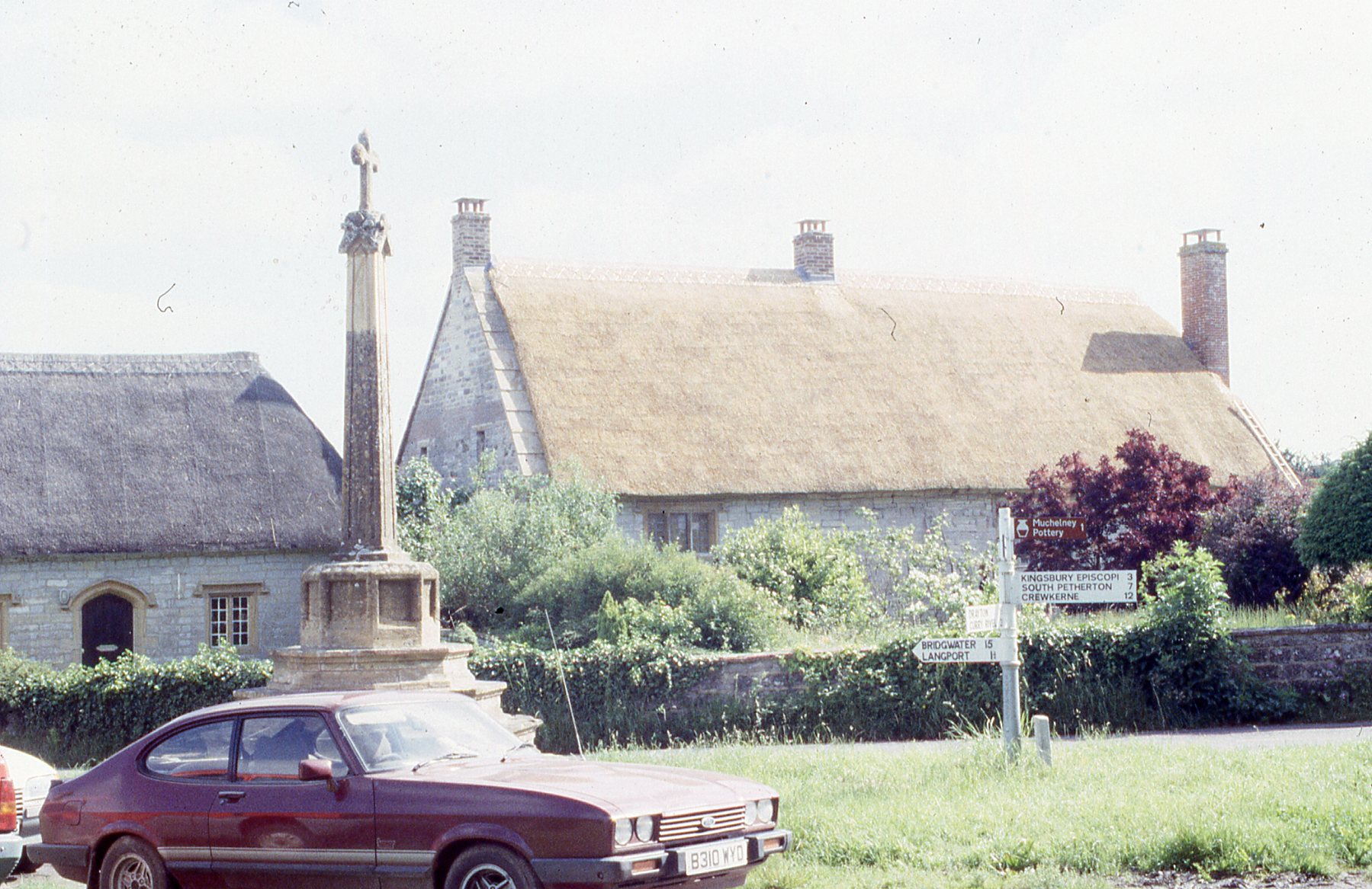
Return to the Priest’s House, Muchelney


Heading south-west out of Wiltshire, along the floor of the Deverill valley. . and at Kingston, climbing out of the greensand, up, up onto the high curvaceous chalkland. The icy gloom giving way to bright skies with a first chance to see the potential of the developing day.

Not until the road came to the brink of the escarpment was it possible to appreciate what was unfolding. Over the brow of the downs, the land dropped away and as far as the eye could see… were flat-lands overlain by undulating mists. Networks of hedgerows were translucently visible but the isolated, conical Duncliffe Hill broke out of the fading milkiness high into the blueing sky.

Below lay the border town of Mere and beyond lay Dorset and….

Somerset:

At Lytes Cary we took the road to Huish Episcopi.

I remembered to turn left at the church tower and onto  the level, hedge-lined road which led across the flats to Muchelney.

The winter of 92-3 was wet and my car had struggled here. The road was flooded. The builders had told me not to wait too long, the water was rising and the village was becoming an island again.  I did the archaeology and thankfully made it back to the mainland that night.

IMG_8626

The Priest’s House in January 2018

Returning after a quarter of a century to this little hill with its church and ruined abbey, it seemed hardly to have changed. A few scattered cottages and there was the Priest’s House. Everything silvered grey with frost..the sun here still only a glowing orb above the mist.

The National Trust has owned this place since 1911. Rescued by the Society of the Protection of Ancient Buildings with work carried out by Ernest Barnsley, a master builder of the Arts and Crafts Movement.

368 10

The Priest’s House after work was completed in April 1993

At the end, I had left it with its fresh yellow thatch ..but knew it in my time mostly as a scaffolded canopy, the skeleton of medieval timbers exposed for repair.

357 8

The medieval common rafters of the hall after removal of thatch. Looking through these you can see the horizontal timber known as the purlin which supports them and below and attached to the purlin can be seen the curving wind braces which demonstrate that the hall was open to the roof in medieval times as does the truss with its principal rafters which the purlin is supported on. This truss has an arch braced collar which was built to be seen as a decorative feature from the ground floor.

This was the early 14th century vicar’s house. The priest was a paid staff member of Muchelney Abbey and took the services in the parish church, serving the village community.

Quite a lowly cleric and the size of his house reflects his status… but he and his home survived Henry VIII’s religious upheavals of 1538-40. At that time most of the Abbey was demolished and the monks were pensioned off. The great Abbey church is just a pattern of stone footings now.

IMG_8623

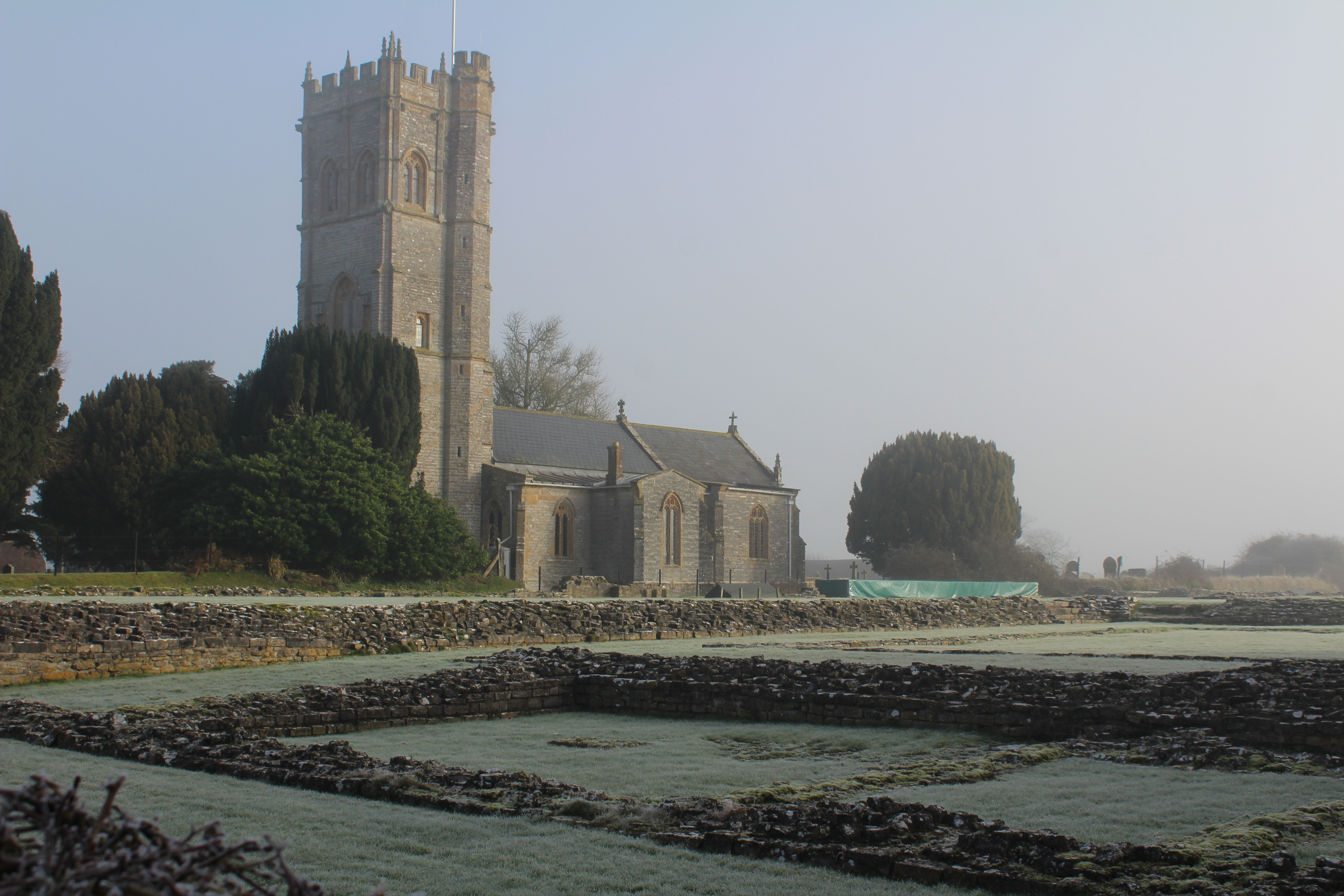
Muchelney parish church seen across the footings of the once much larger Abbey church. The Priest’s House lies just beyond. 

This priest’s house is too far from Ham Hill. This is the edge of blue lias country, the walls are of this grey slatey stone, only the windows and doors are of golden Ham stone.. though it has fenestration way above its pay-scale. I suppose, once the great Abbey had been pulled down there were plenty of opportunities to upgrade from the ruins.

368 11

One of the large windows of the hall. Rather grand for such a small building.

One day the builders showed me 12th-13th century chunks of carved and painted stone they had found during the repairs. This was more re-cycled Abbey, reused as rubble to infill a redundant flight of stairs  up to the first floor.

The Priest’s House had been built with a cross-passage with opposing front and back doors.

368 16

The medieval wattle and daub screen to the guest room under repair. This Tudor doorway was inserted into it when the the first floor was created over the hall.

Through the front door, on the right was a timber screen and beyond it the hall was  open to the roof  decorated with curving wind braces. Beyond the hall was the parlour with its moulded timber ceiling, a stair led to the solar or private room of the priest. Later, the hall was roofed to create a first floor above and a huge decorated stone fireplace was hauled into the room. Evidence of more of the Abbey salvaged from the ruins.

To the left of the cross-passage were the store rooms, the pantry for food and the buttery for drink and the now blocked stair which once led to a guest room above. The kitchen would have been a separate building. In medieval times it was thought sensible to keep the cooking fire from the main building in case of accident. In the builders’ trenches, I never saw evidence for this kitchen though it could have been a timber framed building which left little trace.

Examples of these medieval kitchens still stand at nearby NT places …Stoke Sub Hamdon Priory (‘Prayer for the Future’) and Treasurer’s House Martock (‘The Treasure beneath the Limewash’)… Their residents were grander than Muchelney’s vicar and could afford something more substantial.

IMG_8625

Frosty Muchelney Abbey last week looking across the demolished cloisters towards the Abbot’s hall.

But it was now time to leave Muchelney. There were other places to visit.

We climbed back in the car and continued our journey south between melting frost-spangled fields and sleeping winter-bare orchards …deeper and deeper into cider country….Kingsbury Episcopi, Martock, Stoke Sub Hamdon..Montacute.


The Dunster Castle Mosaics

Dunster Castle in west Somerset, is one of three Wessex Norman motte and bailey castles now owned by the National Trust. Their 11th century designers all used natural hills. Each was a strategic location but history changed them.. only Dunster has remained a residence through 1000 years.. a grand mansion house, impressive in scale and outline, high above the road into Exmoor.

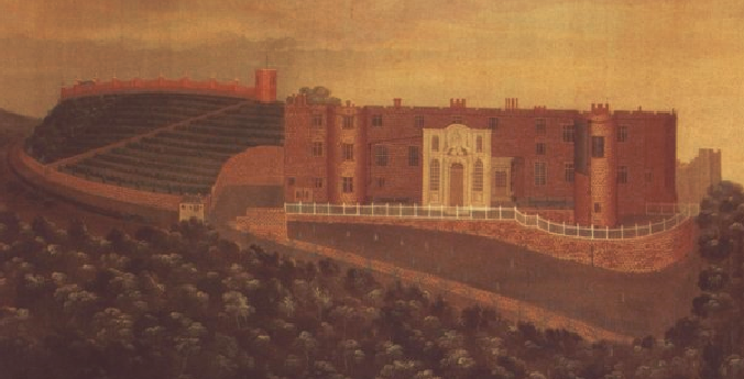
1754 painting2

1754 painting of Dunster’s dramatic setting on display in the Castle

In south Somerset, Montacute Castle, on St Michael’s Hill , is now only visible as earthworks under trees. It ended its military life in the 12th century when the land was given to Montacute Priory.

Corfe Castle thrived as a royal castle, particularly in the 13th century, but had become old fashioned by Tudor times. Elizabeth I sold Corfe and it became a rich family’s trophy house.. They backed the King (the losing side) and so in 1646 it was made uninhabitable. Now it’s a craggy ruin.

Dunster is different.. It survived the turbulent years of the English Civil War. It progressed.. and was developed during the 18th and 19th centuries.. complete with stables, outbuildings designed parkland, gardens and summerhouses.

And so it was… that last August I took the long and winding road from Taunton to Minehead in search of a Dunster mosaic.

Don’t get me wrong… these are pebble mosaics not Roman ones .. but they are intricate designs, hidden and poorly understood.

The thing about Dunster Tor is that it’s got unstable slopes. The paths and access road, spiraling up the steep hill to the Castle’s front door, keep slipping away.

I arrived at the right time, morning tea-break in the bothy, and then Robin the Head Gardener guided me up the hill with drawing board, camera, notebook and measuring tapes.

IMG_4898

Starting to clear the overgown path below the Castle. 

A busy summer day, many visitors enjoying the sunshine but I was shown down a lost path. Closed because of health and safety. It doesn’t go anywhere now. After about 30m, it stops abruptly at a steep slope, where the old route has tumbled down the hill.

Robin found the spot and pulled some creeper plants which had grown across the abandoned path. There, was a pattern of pebbles set in a hard white mortar.

He wished me well and left me to it ..and that was my home for the day.. shaded by the bushes and tall plants and all around me the voices of happy holiday people walking along other paths. Nearby but out of sight.

The path had been cut into the hillside. On the uphill side, I pulled back the greenery and found the red sandstone blocks of the revetment wall. Where the path met the wall there was a heap of soil and roots. I moved the vegetation… and just above the mosaic surface were fragments of plaster and pieces of brick and slate.

IMG_4908

The pebble mosaic running under the revetment wall.

There were also two blocks of stone joined together and forming an 120 degree angle as though they once formed the corner of a polygonal building. The revetment wall had been built above this corner and the mosaic ran up to it….The archaeological sequence .. first the stone corner, then the pebble floor built against it and then, at a later date, the revetment wall for the path built above them.

IMG_4904

Now it was time to clean back from the wall and reveal the pattern of the white pebbles. It was edged with a curving fan of long, pitched, red-brown stones. Then there were zig-zag patterns of long grey stones among the white pebbles. In the centre of each zig and zag, was a rosette of long stones with a pebble in the middle. Beyond that and further downslope there were interlocking arcs of grey stones dividing up the white pebbles…but then I ran out of path.

IMG_4916

The stone rosettes 

Slabs of the mosaic had  fractured and tipped down slope and then had been covered and resurfaced in the 1970s to repair the path and make it horizontal again.

Really good mortar… it held the pebbles fast as the floor cracked and slipped away down the hill.

By the end of the day I’d uncovered about half the surviving semi-circular design. Originally, it must have been about 5m in diameter but ….how old was it and what period in the Castle’s long history did it belong to?

I’ve been writing up the report and the answers are not easy to find.. definitely 18th or 19th century but surely we can do better than that.

There are two known Dunster mosaics. The other one, on the north side of the castle, was built against the 15th century gatehouse. This floor design is a series of concentric pebble petals and was carefully uncovered and drawn in the 1990s. Robert the excavator concluded that the mortar used in the floor was a kind of ‘Roman’ cement and was therefore at least earlier 19th century in date.

The one I had revealed was on the south side of the Castle and although it had a different design, the mortar and types of stone were similar. There is no reason to doubt that they are contemporary and part of the same period of garden design.

Dunster Castle has such a dramatic scenic profile: it has been drawn, painted and mapped many times since the early 18th century.

Changes usually take place when there is money and the Luttrell family (the owner occupiers of Dunster from the 1404-1976) didn’t always have large amounts of spare money.

In the early 18th century, Dorothy Luttrell had cash to spend and used it to redesign the gardens. A drawing of Dunster in 1735 shows a white building in the area where I drew the mosaic. There is a painting dated 1754 which also shows the building. Is this the building which covered the mosaic. There’s no similar structure for the north pebble floor and the the type of mortar doesn’t work for such an early date. ‘Roman cement’ was invented by James Parker in 1798 and is unlikely to have been used at Dunster until the early 19th century.

18th century

The early 18th century painting at Dunster showing a little white building on the left side of the Castle in the area of the pebble floor.

Henry Fownes Luttrell 1747-1780 had money and lived at Dunster much of the time as did his son John 1780-1816 but the next owners lived mainly in London and the Castle went into decline.  Then, in 1867, George Luttrell inherited and took the place in hand. He commissioned fashionable architect, Anthony Salvin, to design a gothic revamp for the place.

The surviving later 19th century photos maps and plans give no hint that the mosaics were created at this time.

However, they may have been designed and seen for just a few years and any covering pavilion or summer house building may have been a light timber framed structure quickly removed.

My best bet… given the type of mortar …and the occupation history of the Luttrell family, is that the floors were commissioned by John Luttrell before 1816… can’t prove it though.

Unfortunately William Turner’s painting of 1811 shows nothing and neither does the tithe map of 1840. But they were  not created to show garden detail….

1840 Dunster

Dunster’s Tithe Map 1840

so I must hope for a future researcher who one day.. at Taunton.. at a table in the Somerset County Record Office…working through deep pile of papers in the Dunster Archive, will suddenly alight on the conclusive document ….I hope he or she spots it.


All I want for Christmas……

It’s always exciting when I am handed bags of finds from work done by archaeological contractors in and on our properties.

Box of delights

Box of delights

This week it was a few objects found by Ian, while doing a building survey, they were under the bedroom floor of a farmhouse in North Somerset. The main part of the house dates to the 18th century but it looks like it could go back  to the 16th or 17th centuries and was at times the home farm for a bigger estate.

I took out the bags and noticed it said wooden animal on all of them, so not the usual nails, fragments of wall paper, cigarette packets or chewed up paper from rat nests!

I took them out one by one, they were a bit nibbled but still recognizable as animals. But apart from the piggy they did not look like ordinary farm animals.

The wooden animals a pig, a Deer/Lama and a Sheep/?

The wooden animals a pig,  a Deer/Lama/?  and a long  legged Bear/?

I wondered if they could be from a set of Noah’s Ark animals, I remembered seeing one at one of our properties, so I searched our collections database and found quite a few images of very similar animals to the ones Ian found.

Wooden animal from the collection at Erddig, Wrexham

Wooden animal from the collection at Erddig, Wrexham

Wooden animals for Noah's Ark, from Felbrigg, Norfolk

Wooden animals for Noah’s Ark, from Felbrigg, Norfolk

Our animals have the remnants of paint on them so would probably have looked a little bit like the set below.

Wooden toy figures of Noah and his wife, and pairs of animals, next to the Ark, at Scotney Castle, Kent.

Wooden toy figures of Noah and his wife, and pairs of animals, next to the Ark, at Scotney Castle, Kent.

Close-up of the Pig showing evidence of paint

Close-up of the Pig showing evidence of paint

Close-up of the possible Bears head

Close-up of the possible Bears head

Probably more like this set from  Snowshill Manor

Close view of the wooden Noah's Ark with model animals made in the mid-C19th in the Black Forest area of Germany, collected by Charles Wade and displayed with other toys in Seventh Heaven, Snowshill Manor.

Close view of the wooden Noah’s Ark with model animals made in the mid-C19th in the Black Forest area of Germany, collected by Charles Wade and displayed with other toys in Seventh Heaven, Snowshill Manor.

So the rest of  the title would be ….. the rest of the Noah’s Ark animals, oh! and an Ark to put them in.


English Landscape Gardens & Roman Chedworth

I enjoy having a theory and making leaps across time. It may be true, partly true or completely wrong but it feels good at the moment.

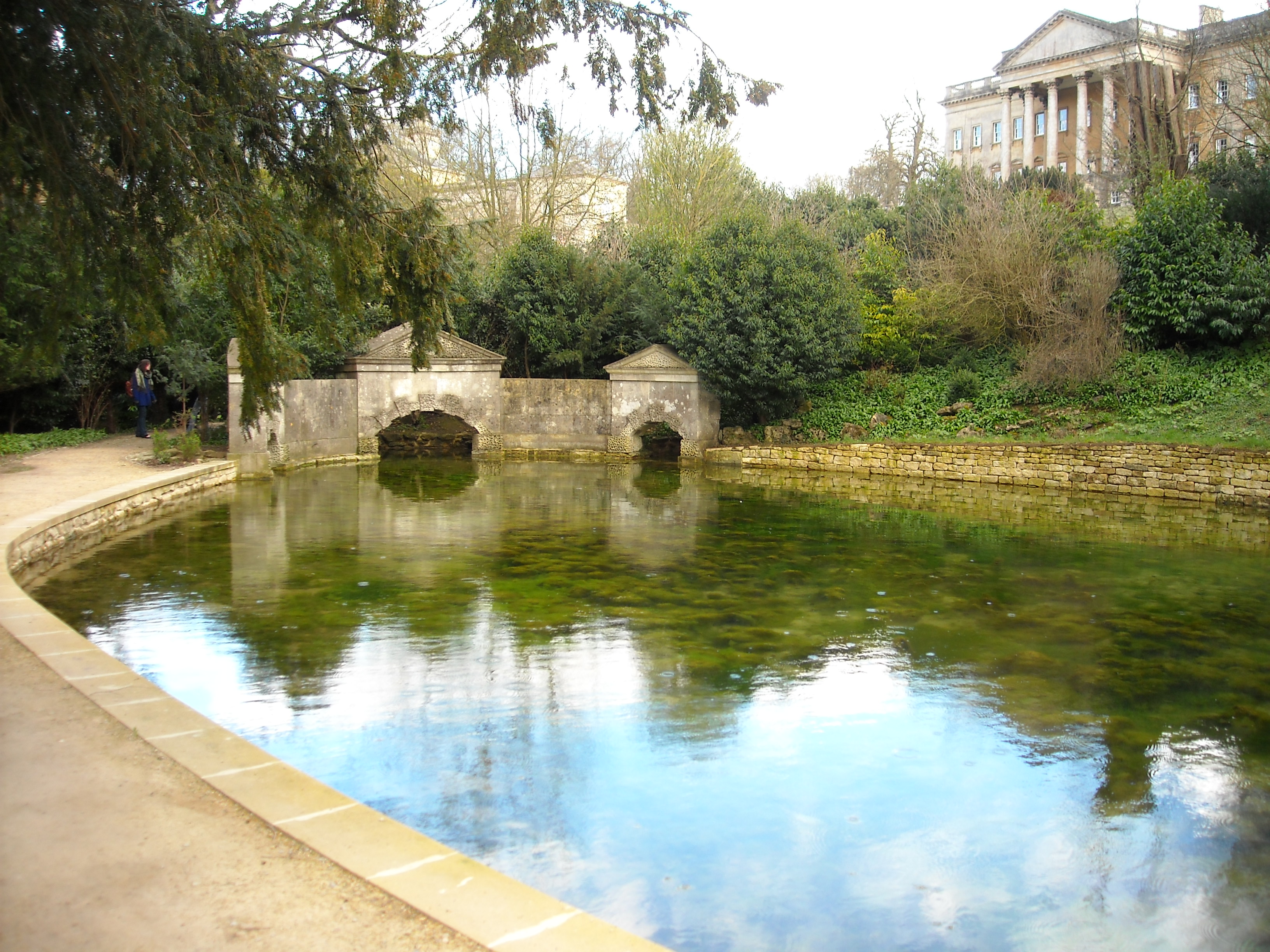
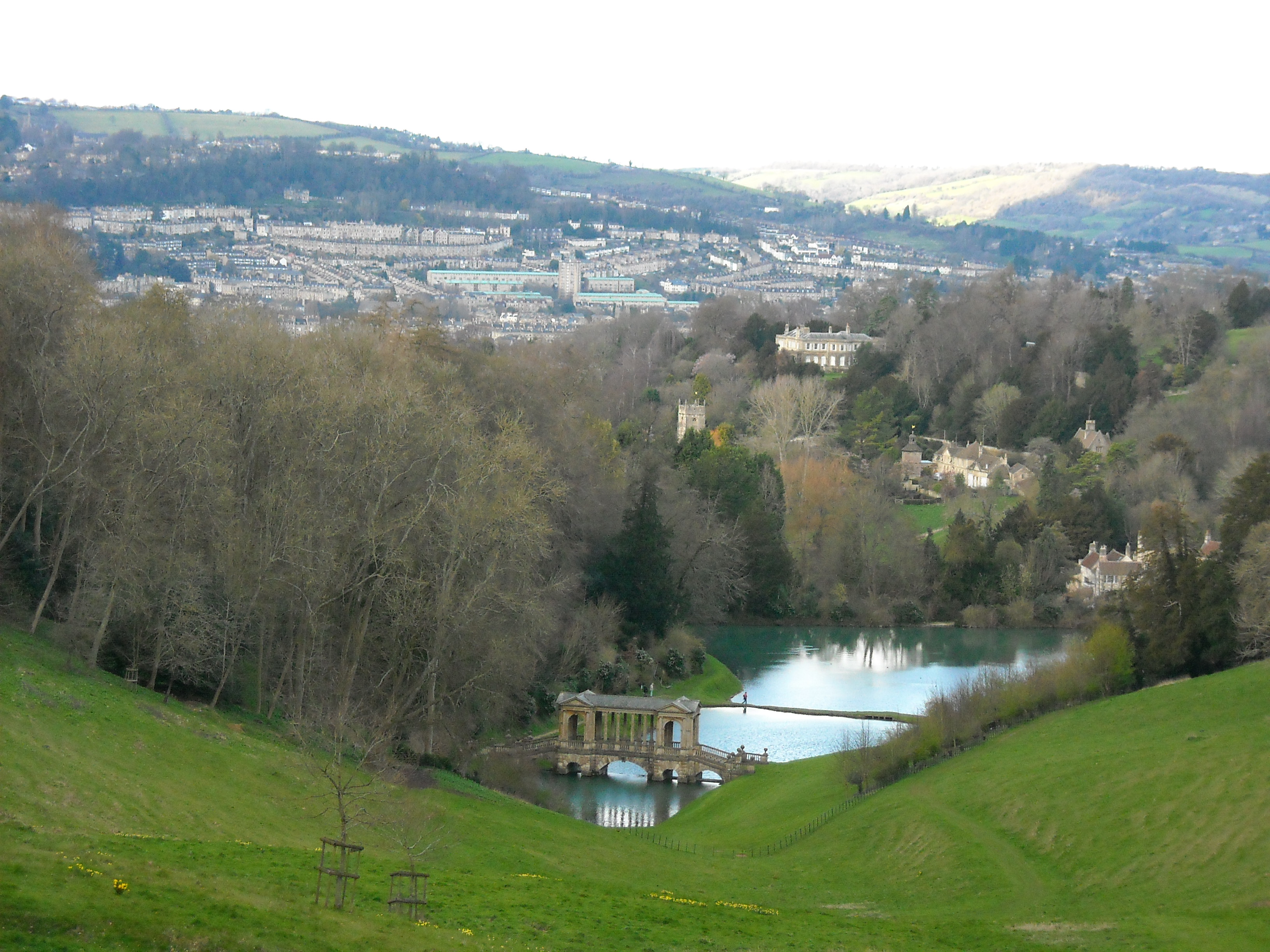
Prior Park, Bath. The 18th century Serpentine Lake and Sham Bridge with Ralph Allen's mansion behind. These buildings were inspired by Roman architecture, very fashionable in the 18th century.

Prior Park, Bath. The 18th century Serpentine Lake and Sham Bridge with Ralph Allen’s mansion behind. These buildings were inspired by Roman architecture, very fashionable in the 18th century.

One of the particular things about working as an archaeologist for the National Trust is that it’s difficult to escape garden archaeology. I noticed it when I first arrived, the Trust is full of diversity but gardens are important and English neo-classical 18th-century landscape gardens particularly so. Britain is quite famous for them.

The view out from Ralph Allen's neo-classical mansion across his landscape garden (created 1740s-60s) to the Georgian city of Bath. Placed in an ideal landscape setting between two lakes is the Palladian Bridge, one of only three in the country (the others are at Wilton House and Stowe).

The view out from Ralph Allen’s neo-classical mansion across his landscape garden (created 1740s-60s) to the Georgian city of Bath. Placed in an ideal landscape setting between two lakes is the Palladian Bridge, one of only three in the country (the others are at Wilton House and Stowe).

It was the thing to do, particularly from the mid-17th to mid-19th centuries. One just had to do the Grand Tour and visit the key places of ancient Rome and Greece. Rich young men would have been fluent in the classical texts, say in the letters of Pliny the Younger. In the 1st century, Pliny praised the value of his villas as country retreats for health, relaxation, recreation and seclusion and when they returned 18th-century landowners created such classical landscapes in their grounds.

Very fashionable. Quite the thing and they had loads of money. Ralph Allen made his cash by quarrying Bath stone and supplying it to rebuild Bath in the classical style. He built a massive mansion above the city and on the valley slopes below he had built lakes, cascades, a grotto, an ornate ‘Palladian’ bridge and various garden buildings linked by paths lined with shrubs and statues in Greek and Roman style.

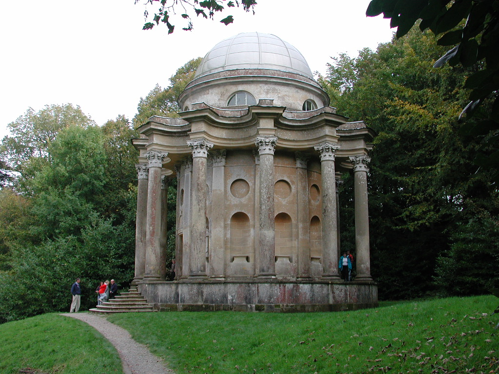
The Temple of Apollo at Stourhead, Wiltshire  commissioned by the landowner Henry Hoare and placed  on a spur of land above the ornamental lake to be seen and to from whic to view other classical garden buildings such as the Pantheon and the Temple of Flora.

The Temple of Apollo at Stourhead, Wiltshire commissioned by the landowner Henry Hoare and placed on a spur of land above the ornamental lake to be seen and to from whic to view other classical garden buildings such as the Pantheon and the Temple of Flora.

Henry Hoare made his money in banking and purchased the old Stourton Estate in Wiltshire. He appointed consultants to create a neo-classical mansion, dam the River Stour at its source and created lakes. Around the lake and on the valley slopes his designer placed classical temples, obelisks and a grotto. The walks and carriage rides enabled each garden building to be glimpsed from the next. Certainly something to impress his mates and his clients.

The source of all this was Greece and Rome. Surviving texts from Ancient Rome describe sumptuous gardens surrounding villas which were the source of the English designed landscape ideal.. so don’t we have evidence of designed landscapes from Roman Britain. Seems reasonable, we’ve got mosaics, painted plaster etc. copied from Rome.. what about landscapes. They’re less easy to see but Chedworth seems a good candidate.

Chedworth is not on its own. It is one of a group of villas surrounding Roman Corinium (Cirencester). The country seats of the rich. Impressing the neighbours/ clients/ boss has always been important.

Chedworth is perched at the head of a narrow valley sloping down to the River Coln. The National Trust only owns the villa ruins which were purchased for the charity in 1924 when the Stowell Park Estate was sold. All the land around the Roman mansion was once part of the villa estate so we wanted to know more about its setting.

The position of Chedworth Roman villa at the head of its valley. The most visible building now is the Victorian lodge built with a site museum soon after the villa excavation in 1864. The Roman building rubble   found by Matthew can be seen against the field edge top right. The photo is taken from the mound which  covers another Roman building. The road to the villa was seen on the geophysical surveys running up the centre of the valley with two parallel linear banks and ditches lying equidistant and flanking the road about 30m from its edge. Perhaps they marked an avenue of trees making a grand approach to the villa. The tradesmans's entrance was probably screened running along the south side of the valley to the left of the photograph. The circular'Capitol' found in 1864 would have been visible on the skyline in Roman times but the footings of this building were removed by the railway after 1889.

The position of Chedworth Roman villa at the head of its valley. The most visible building now is the Victorian lodge built with a site museum soon after the villa excavation in 1864. The Roman building rubble found by Matthew can be seen against the field edge top right. The photo is taken from the mound which covers another Roman building. The road to the villa was seen on the geophysical surveys running up the centre of the valley with two parallel linear banks and ditches lying equidistant and flanking the road about 30m from its edge. Perhaps they marked an avenue of trees making a grand approach to the villa. The tradesmans’s entrance was probably screened running along the south side of the valley to the left of the photograph. The circular’Capitol’ found in 1864 would have been visible on the skyline in Roman times but the footings of this building were removed by the railway after 1889.

These places were usually the centres of farming estates (as were places like Stourhead 1400 years later), though nobody has yet found the farm buildings for Chedworth villa. So last year we asked for permission from the Stowell Park Estate to carry out a geophysical survey of the field east of the villa. No farm buildings but a mound at the bottom of the villa marked the site of a circular building defined by a ring of circular features (column bases?).

This year Matthew met us during the excavations at the villa, Stowell Park Estate had given him permission to carry out a metal detector survey of the whole field.

An early 4th century coin of Constantine the Great found amongst the rubble of the building found this year.

An early 4th century coin of Constantine the Great found amongst the rubble of the building found this year.

We walked down the valley and he explained what he had found. The mound was definitely Roman. He took me to a pile of rubble on the other side of the valley in sight of both villa and the mound. He had found coins and building material there dating from the 2nd-4th century, including window glass and lead.

The spread of rubble against the field edge above the valley floor. Here glass, nails, lead, coins and Roman pottery of 2nd-4th century were found.

The spread of rubble against the field edge above the valley floor. Here glass, nails, lead, coins and Roman pottery of 2nd-4th century were found.

He said that the rest of the field had few metal signals and therefore these were two isolated buildings, perhaps pavilions and/or shrines which served as eye-catchers for honoured guests approaching the villa (I guess the tradespeople used the back entrance. In the 18th century, designers made sure that the lower ranks didn’t spoil the vistas when they made their deliveries). Other buildings and earthworks are known from the surrounding valley sides, including the circular ‘capitol’ excavated in 1864 on the crest of the ridge behind the villa.

Stourhead, Wiltshire, two garden structures, intervisible within their landscape setting. The Bristol Cross in the foreground and the Pantheon beside the lake in the distance.

Stourhead, Wiltshire, two garden structures, intervisible within their landscape setting. The Bristol Cross in the foreground and the Pantheon beside the lake in the distance.

So that’s my leap of imagination based on the evidence, an 18th-century Stourhead or Prior Park type landscape at Chedworth.

Deep Time in Ebbor Gorge

I do this each year and usually alone. I took Simon the wildlife adviser once.. and at this stage.. perhaps it falls more within his department.

The Somerset Levels looking towards Glastonbury Tor from the Mendips above Ebbor Gorge

The Somerset Levels looking towards Glastonbury Tor from the Mendips above Ebbor Gorge

I drive up onto the Mendips, turn left at Priddy, follow a narrow twisting lane and park. The views out though the gateway are immense. The sweep of the Somerset Levels, with Glastonbury Tor and Burrow Mump projecting from the flat lands.

Burrington Coombe and Cheddar have roads running through them but Ebbor Gorge is only accessible by narrow footpaths. From the grassy car park you cross a stone style and plunge into woodland. As you descend the steps, you start to feel that the modern world has been lost. Who knows what ancient creature might emerge from the dense vegetation. It feels like a remote place and the bottom of the gorge is warm, still and humid. Then there is the steep ascent up the other side, pausing for breath from time to time, keeping an eye open for the slight hidden path created for the dig between the trees, along the gorge edge.

The woodland path into Ebbor Gorge.

The woodland path into Ebbor Gorge.

There it is. I weave up and down and start to hear faint voices. Turn a corner and the cave is there. Much activity and a welcome from Danielle who has been expecting me.

Many of the Ebbor Caves were discovered by Victorian and Edwardian explorers and dug away. There are displays of some of their finds at nearby Wookey Hole. They were big on enthusiasm but their techniques were not great.. so to find an unexcavated cave is exciting and rare.

The Gulley Cave in 2005 before excavation.

The Gulley Cave in 2005 before excavation.

Ebbor is a Natural England reserve leased from the National Trust. Bob Corns, the NE ranger showed me the potential of Gulley Cave in 2005 and Danielle and her team from Royal Holloway College, London have been investigating the site since 2006. They are top experts in the Palaeolithic and each year descend a little further into the remote past. They tell me that this is an extremely important site. 40% of the cave deposits have been preserved for the future and have been kept in place by scaffolding.

The finds consist of animal bones, beautifully preserved because of the lime-rich conditions of the soil. Danielle tells me about the extreme cold following the last glaciation. We would have to go to the Russian Steppes to find such conditions today and the animal bones in the cave reflect this. Lemming, arctic fox, wild cat, an extinct type of wild pony, reindeer and hundreds of tiny animal bones. These are the remains of voles and other small rodents probably brought to the cave as pellets from hunting birds like owls. They have provided a range of radiocarbon dates from 10,000-13,500 years ago. The changing types of rodent reflect the fluctuations in temperature during the Holocene.

The limestone soil preserves bones extremely well. Danielle holds a wildcat jaw and the massive bone in the background is the femur an extinct species of giant cattle (aurochs)

The limestone soil preserves bones extremely well. Danielle holds a wildcat jaw and the massive bone in the background is the femur of an extinct species of giant cattle (aurochs)

The hope is for evidence of human occupation but no tools have been found. The larger meat bones have been discovered welded to the back of the cave with a hardened lime solution, which seeped from the cave wall over time.
The massive bones, representing the haunch of an giant extinct type of cattle (aurochs) were found there. Not something that would be tip-toeing around the gorge and probably too large to be brought there by wolves. Another long bone showed burning and had been fractured to extract marrow.

These are the clues at the moment that a family hunted and brought meat joints hear, roasted them on a fire and had meals in Gulley Cave, perhaps cleaning up the bones by placing them at the back of the cave. The south facing view from the cave mouth across the gorge would make it a good secure, sheltered home.

The cave has filled up over many thousands of years. Beneath a thin crust of lime which has dripped and accumulated from the cave roof is a breccia deposit of soil and stone deposited during post-glacial cold tundra conditions 11-14,000 years ago,.

The cave has filled up over many thousands of years. Beneath a thin crust of lime which has dripped and accumulated from the cave roof is a breccia deposit of soil and stone deposited during post-glacial cold tundra conditions 11-14,000 years ago,.

This year, Danielle told me, the finds have been few. The excavation has entered the last ice age. 15,000-25,000 BC was a very cold time and people probably didn’t live in Britain then. The soil has changed to frost fractured fragments of rock. Below this, about 30,000 year ago, might be found remains of woolley rhino, mammoths and perhaps earlier remains of Neanderthal man.

The story continues. I think that I will be visiting this cave each summer in years to come. This is rare evidence for deep time and Gulley Cave is yielding a fabulous stratigraphy.

Gulley Cave this year. Below the tundra soils is a deep deposit of frost fractures stone. These accumulated during the last glaciation which was too cold for people to live in Britiain it is thought.  Depth of this glacial period of cave filling is unknown but scaffolding has been inserted to hold back the reference section as the cave gets deeper. The next soil layer and warmer period will indicate deposits about 30,000 years old.

Gulley Cave this year. Below the tundra soils is a deep deposit of frost fractures stone. These accumulated during the last glaciation which was too cold for people to live in Britiain it is thought. Depth of this glacial period of cave filling is unknown but scaffolding has been inserted to hold back the reference section as the cave gets deeper. The next soil layer and warmer period will indicate deposits about 30,000 years old.

The Hot-house of Desire

Tyntesfield c.1900. A fancy dress party in the conservatory

Tyntesfield c.1900. A fancy dress party in the conservatory

Or to put it another way.. The conservatory of choice.

When William Gibbs desired to alter his gothic mansion in north Somerset, he wanted it to be the very latest thing and he had plenty of money. He had made a mint by investing in South American fertilizer (guano… fossilised bird droppings)

In the 1860s, he appointed the architect John Norton to redesign Tyntesfield and part of the plan was to create a splendid conservatory (not quite a Crystal Palace but big).

There had been a conservatory when William purchased the house in 1843 and he may have altered it to suit his taste soon afterwards. However, the 1860s conservatory was much larger by comparison, measuring 80ft long an 50ft wide. It had an intricate iron framework and a dome at the centre.

A door gave direct access from the west side of the house via a corridor between the Billiard Room and Mrs Gibbs Room. It was full of exotic plants from around the world and heated by hot air created by a newly installed boiler. The details are recorded in an article contained in The Builder magazine published in 1866.

A picture dated 1867 of the conservatory from the west lawn of the house soon after its completion.

A picture dated 1867 of the conservatory from the west lawn of the house soon after its completion.

Over the next 50 years, the conservatory was visited by many people including plant collectors and botanists from Kew Gardens and there were numerous parties and social gatherings, but by 1917 it had become unfashionable and difficult to maintain and so George Abraham Gibbs decided to demolish it.

Only the footprint of the site is visible now and Paul the Head Gardener would like to know what survives beneath the gravel. So this week, National Trust archaeology will find out, and we will update this blog each day to let you know how we get on.

Conservation Audit

A few years ago we carried out an archaeology audit for NT Wessex. We gave a significance grade for all the properties A* to D (we are renewing it this year).

There were some obvious top hitters, like the famous Wiltshire World Heritage site(s) but there were the other A* places like Whitesheet Hill on the Stourhead Estate and Brean Down jutting out into the Severn Estuary. Collections of concentrated archaeology spanning the Palaeolithic to the Cold War.

The Cottage in which Thomas Hardy wrote his first poems and novels near Dorchester

The Cottage in which Thomas Hardy wrote his first poems and novels near Dorchester

Many properties were acquired with no thought of archaeological significance but it is hard to find a place that has nothing worthy of interest. Thomas Hardy’s cottage near Dorchester is perhaps just another 19th century cottage, a new build on heathland. I try to grade it low but when a trench uncovers a scythe, a medicine bottle and a marmalade pot used by his family, there is suddenly a physical link to the great Dorset writer that is difficult to ignore (he wrote “Far from the Madding Crowd” here).

19th century debris, once used by Hardy's family and found during an excavation last year.

19th century debris, once used by Hardy’s family and found during an excavation last year.

As for Max Gate, the nearby house he designed and lived in later in life, the property is massively important. Not for the Victorian house (unless by association with the great man) but because it lies above a Middle Neolithic enclosure almost 5000 years old. It is one of the closest matches to the earthwork around Stonehenge. It was discovered in the 1980s when the Dorchester bypass was constructed and all that remains (over 50%) lies under Max Gate.

Snowshill in Gloucestershire, is also not known for its archaeology. It’s about a unique collection of stuff put together by eccentric Charles Wade in the early 20th century, but it occupies a medieval monastic lodge converted to a manor house.

Snowshill Manor. The site of Wolf's Cove lies on the left side of the main house.

Snowshill Manor. The site of Wolf’s Cove lies on the left side of the main house.

Snowshill was the last Conservation Performance Indicator meeting (see March 16th “Shall we Stack the Naked Acres”) for old Wessex this year. Strangely it was not held in the Cotswolds but in a wooden hut in Leigh Woods (just as nice).

Snowshill has a lost village called Wolf’s Cove which will be excavated this year. It will then be completely reconstructed based on documents and archaeological evidence.

Quirky and true to Snowshill’s spirit of place. Wolf’s Cove was a model village with canals, harbour and railway created and developed into the 1930s and then removed in the 1970s. It’s still archaeology.

Finished by lunch time, I was then released into the Spring. Leigh Woods is a fabulous place on the edge of Bristol. Purchased and given to NT over 100 years ago by the Wills family to prevent it being developed. It is fringed by grand Edwardian houses (a clue to what might have been) but it survives as a quiet haven.

The view across the gorge to Clifton hillfort from Stokeleigh. Brunel's famous bridge on the right.

The view across the gorge to Clifton hillfort from Stokeleigh. Brunel’s famous bridge on the right.

I asked Bill the ranger how the uncovering of Stokeleigh Camp was progressing and he told me about the work on revealing the outer rampart. I took my lunch and prepared myself for the view. On a day like this, with the fresh leaves all around, it was great to sit on the edge of one of the lesser known but massive Iron Age hillforts in the south west. I chose a good vantage point and looked down into the Bristol Avon Gorge towards Brunel’s Clifton Suspension Bridge. Stokeleigh is the best preserved of the cluster of three forts guarding the gorge. Burwalls Camp has been largely destroyed by a housing development and Clifton, across the gorge, has been partly built on and gardened.

A freestanding copy of an Iron Age roundhouse built within the hillfort in 2009 as part of the celebrations for  the centenary of acquisition. Newly cleared ramparts behind.

A freestanding copy of an Iron Age roundhouse built within the hillfort in 2009 as part of the celebrations for the centenary of acquisition. Newly cleared ramparts behind.

Stokeleigh Camp is a conservation success story. Let to another organisation for many years it became overgrown and difficult to see and understand. The NT took it back in hand. In the last few years, the rangers and volunteers have returned it to woodland pasture leaving only the ancient pollarded oaks. No good clearing scrub from a site without grazing. A higher level stewardship scheme has provided the funds to introduce a few Red Devon cattle that keep the regrowth down. The place is now as it was in the early 19th century, when artists would come out from the city and sketch the landscape from the ramparts.

Prayer for the Future

This week, we met round a table at the Custard Factory in Birmingham. The NT archaeologists from the far reaches of England, Wales and Northern Ireland (Scotland has its own NT). A smaller table than in the past. We unpacked out lap-tops and shared our experiences and inspirations.

Day two was to tackle new technology, particularly aerial and ground based 3D laser scanning. Amazing virtual worlds generating the need for masses of digital storage space. How and when should we commission it and how can we put it into a long term archive so that years from today memory hard drives will be dusted down and the data viewed again and compared.

The priests' chantry house right and stables left

The priests’ chantry house right and stables left

Bill, the point-cloud surveyor had offered me a free digital survey of Stoke Sub Hamdon Priory in south Somerset..so I showed it. Every stone could be measured, elevations and plans could be drawn. Just as well it was free because Stoke has very little money. It is a very rare gem but a scar on the conservation sensibilities. Freya, the historic building specialist had given her time and described its significance. There is nowhere like it now.

We almost achieved a grant to re-roof the dovecot and barn..we will keep trying.

The dovecote and roofless north barn

The dovecote and roofless north barn

Inside the dovecote

Inside the dovecote

The name is a good description.. except it’s not a priory.. it’s a chantry (what?).Stoke is a Saxon name for a secondary settlement. Sub is under or at the foot of, Hamdon means hill enclosure or in the celtic sense of Dun,  a hill top stronghold. Very apt, as Ham Hill is the largest Iron Age hillfort in the country.

Part of the hill has been brought down to the little village. The unique golden stone from the hill has been used to build and rebuild the village over at least a 1000 years.

Ham Hill above the Great Barn

Ham Hill above the Great Barn

Stoke Priory (which isn’t) is a lovely group of medieval buildings. It once served a castle or fortified manor and its ornate chapel. Both are now gone and lie under a farm and housing development.

The castle had been built by Lord John Beauchamp and when he died his grieving family wanted to do something for him and his memory. How do you give something to someone when they are dead. The answer, in the early 14th century, was to create a chantry.

They built a small monastic community and gave land and a farm to sustain it and appointed 5 priests to pray for John, his family and the king 5 times a day in the chantry, every day, for ever. The family died, the chapel and castle fell into ruin but the chantry carried on for 245 years until Henry VIII’s son Edward closed it in 1549.

 It is made of such good stone that the chantry house, barns, stables and circular dovecote still survive and are well worth a visit. The Trust have owned the buildings since 1946. We will work for their future, searching for funding to roof the roofless barns and dovecote and maintain Stoke Sub Hamdon Priory (chantry) for ever.. but now for everyone rather than just a wealthy medieval lord and his family.

Gateway to Nowhere..

IMG_2139[1]

IMG_2152[1]

This is a gateway that now leads to nothing but a patch of grass.

Above is a gatehouse with windows and roof timbers typical of the medieval period.

What was it for? Where did it lead to?

It is all that remains of the old manor house, once the centre of the 12,000 acre Holnicote Estate in West Somerset. It burnt down hundreds of years ago but this gatehouse somehow survived surrounded by later workshop buildings.

Chris the building surveyor took me there on Monday. It needs a roof repair to protect the timbers from damp and at the same time we will carry out tree ring dating to get a precise date for its construction.

As trees grow they create annual rings and the pattern of rings depends on the weather. Timbers with 50 rings or more create a unique pattern that can be precisely dated, especially if there is sap wood surviving at the edge.

For Horton Court in Gloucestershire we had a date of Spring 1517 for the construction of a garden building, which is extraordinarily accurate when compared to other dating methods like Radiocarbon analysis.

The gatehouse is one of hundreds of buildings on the Holnicote Estate. Many are very old. We visited a cottage in Tivington made of earth and stone. The tenants love their home and told us about the smoke in the attic and the cattle in the kitchen.

Where do archaeologists go to find the age of buildings? The best place is often the roof because it is generally the least lived in and therefore least changed. The roof timbers of this cottage showed smoke-blackening.

This was first built as a medieval long house. Livestock at one end and the family in the other with a timber cross-passage screen between and open to the rafters. No fireplace, just an open hearth with smoke wafting up and blackening the roof timbers.

So many generations since then.. inserting Tudor floors, Jacobean fireplaces, 18th century bread oven, new windows in the Victorian window and now the colour HD TV plays cash in the attic as we discuss the cracks in the walls.