The Wessex Hillforts & Habitats Project

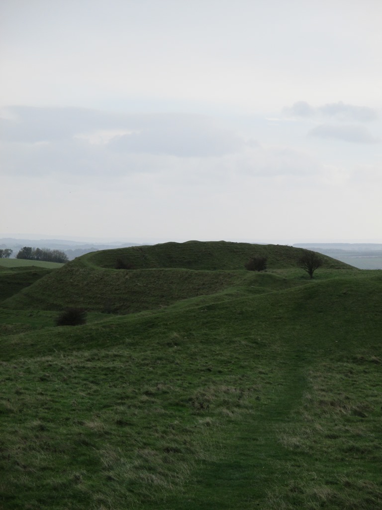
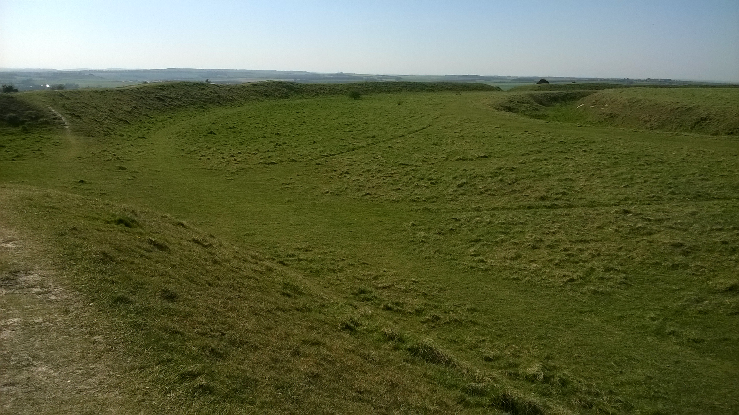
Early morning last week…a drone took off over Hambledon after light snow. Perfect conditions, the snowflakes had settled into the valleys of the great encircling hillfort ditches… and streets of round house platforms became visible as rows of hollows outlined in white.

Hambledon Hill light snow shows the dimples where Iron Age round houses once stood.

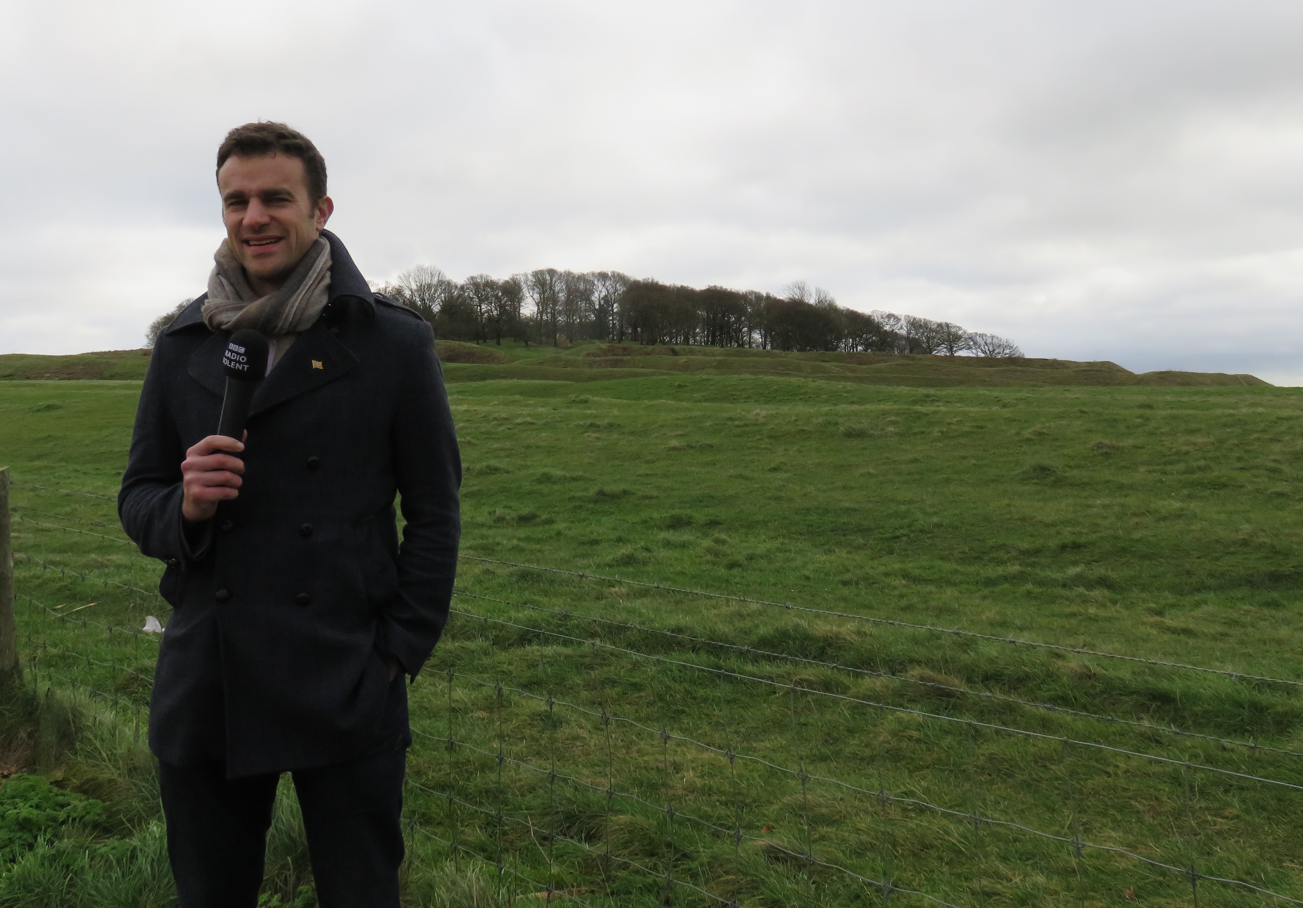
These photos help illustrate the majesty and awe of this vast archaeological site and has helped us launch the National Trust’s Wessex Hillforts and Habitats project. With the help of Marie, our project officer, the People’s Postcode Lottery have granted over 100,000 pounds to get the project started.

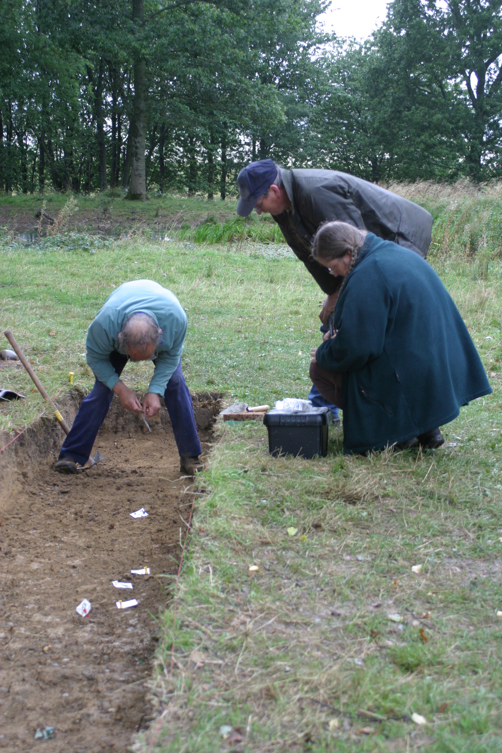
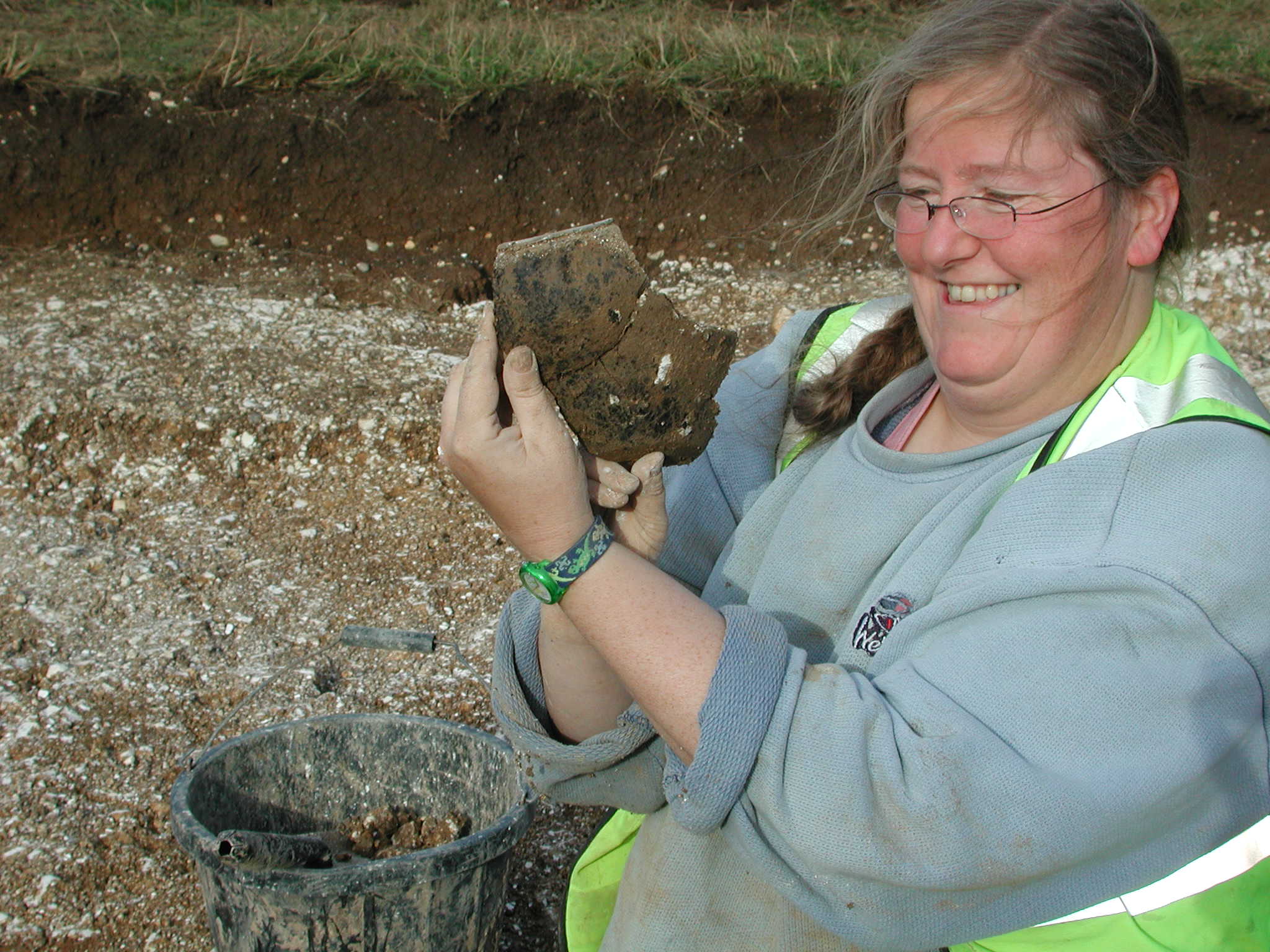
The primary purpose of the project is to enhance the conservation of 13 NT Iron Age hillforts scattered across Dorset and South Wiltshire …but it will also inspire people to get involved and to carry out monitoring and research. It will also create new interpretation to bring these grassy hill top earthworks to life as places to be appreciated, valued and better understood. Alongside this.. to highlight nature, particularly the plant and insect life. Each hillfort’s unique topography nurtures precious habitat undisturbed by agriculture for over 2000 years.

Purple spotted orchids growing on the sheltered slopes of a hillfort ditch

So.. where are these places. I’ll list them out for you…. and as some have featured in previous blog posts I’ll reference these while we have a quick tour.

We’ll start in Wiltshire and from there head south and west and eventually end at the Devon border.

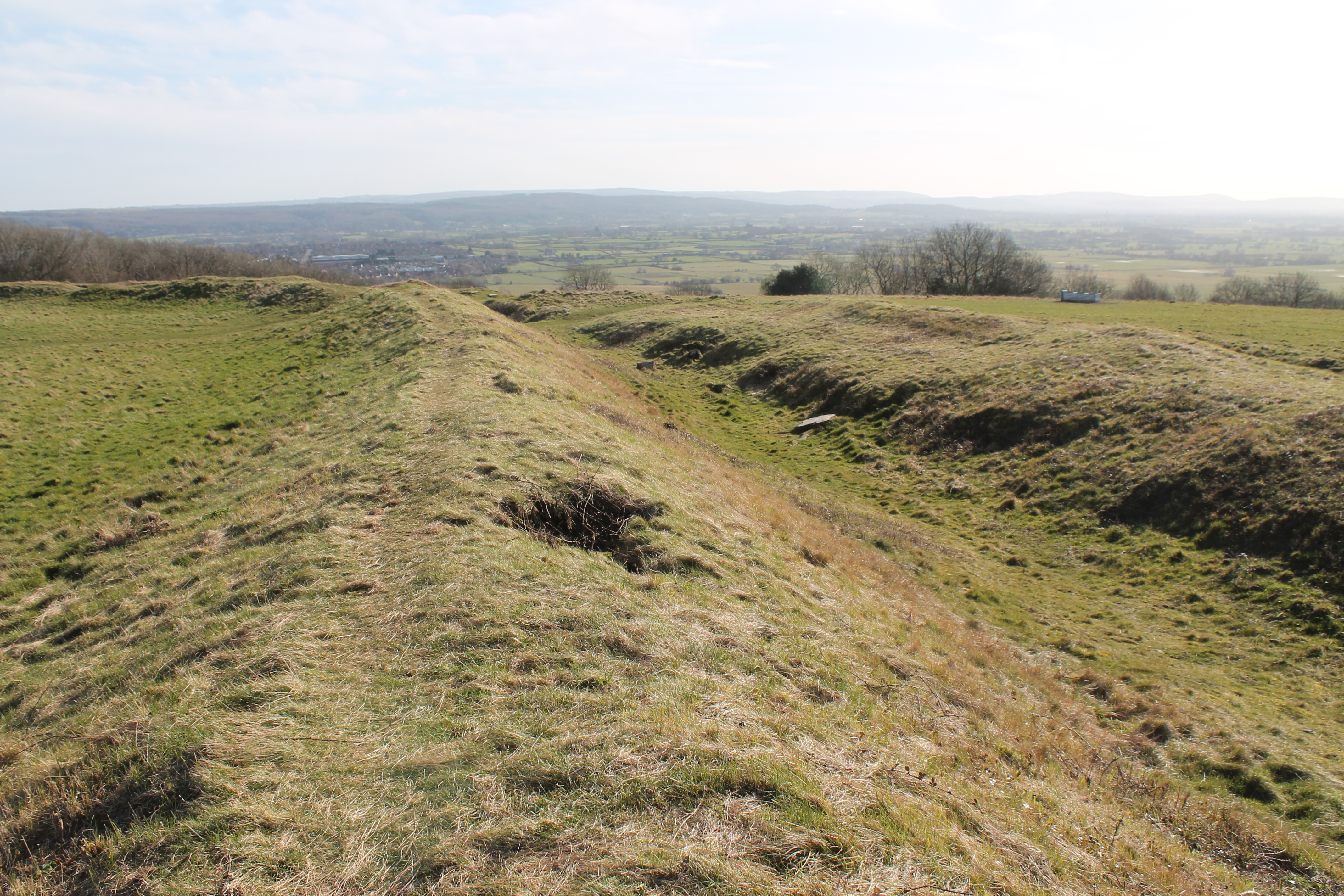
Figsbury Ring, north-east of Salisbury. A circular rampart and ditch with a view back to the great cathedral spire. Strangely, Figsbury has a wide deep ditch within the hillfort ..potentially Neolithic but there is no rampart.. where did all the chalk go?

Figsbury Ring from its rampart top showing the wide deep ditch inside the hillfort.

South of Salisbury, Wick Ball Camp above Philipps House, Dinton.. NT only owns the outer rampart.

Then there is the icon of Warminster, Cley Hill (blog posts “Upon Cley Hill’; Upon Cley Hill 2”), a flying saucer shaped chalk outlier with two round barrows on the summit..a strange hillfort.

To the south west, at the source of the mighty River Stour, is the Stourhead Estate with its two hillforts. These are Park Hill Camp, its views hidden by conifer plantation and Whitesheet Hill  (blog Whitesheet Hill Open at the Close) with wide prospects across the Blackmore Vale towards Hambledon and Hod. We’ll follow the Stour to reach them.

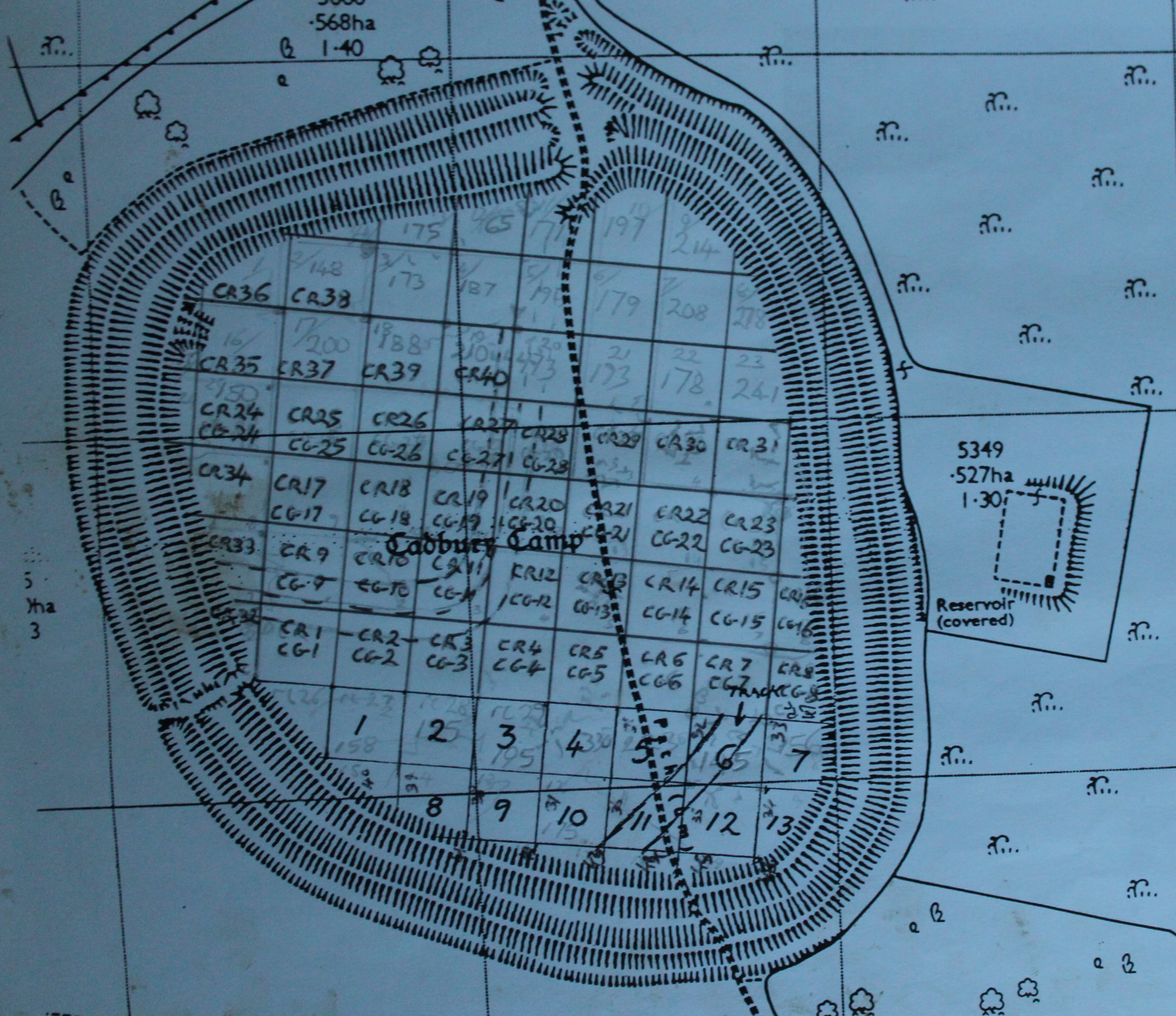
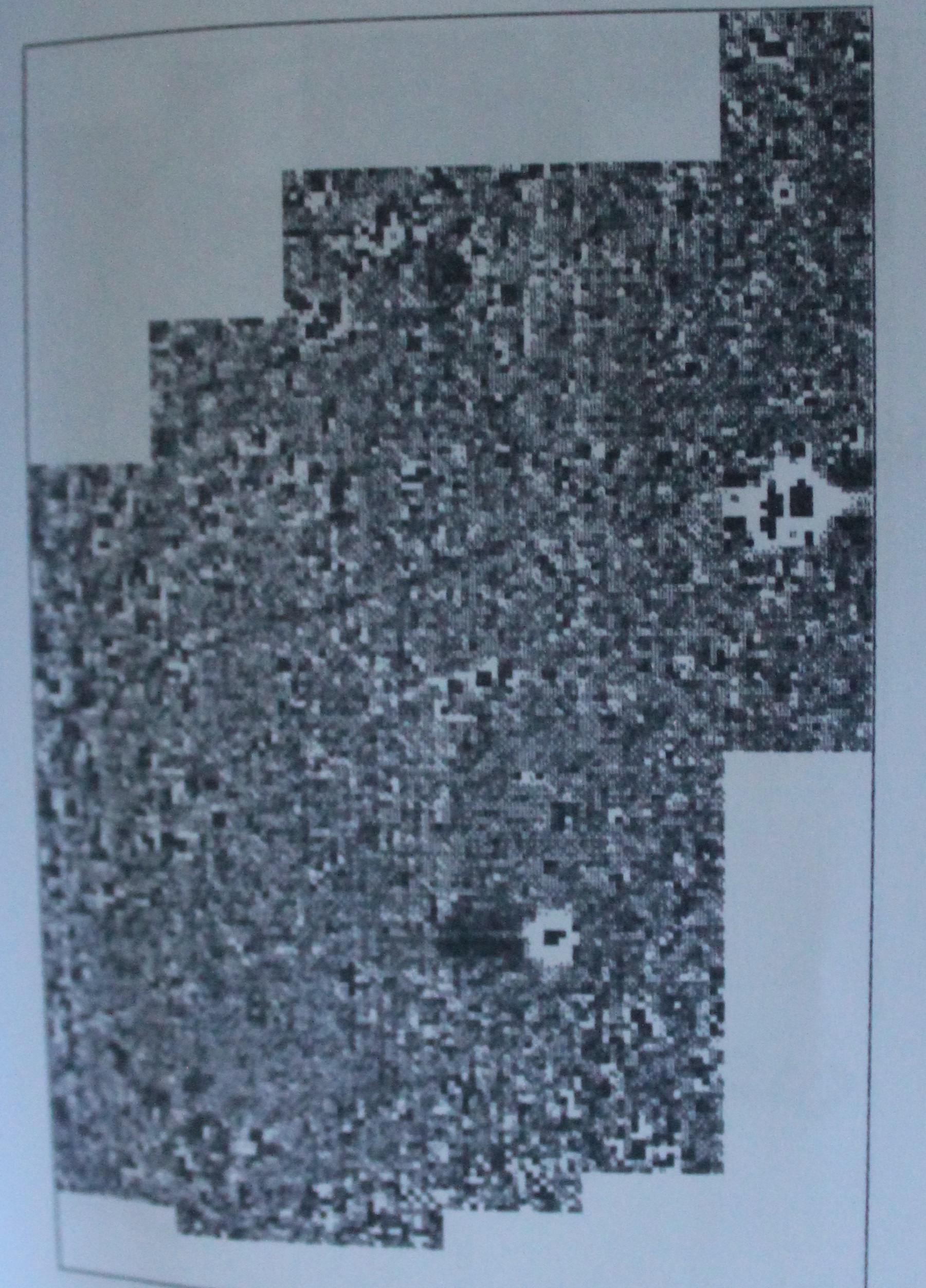
Hod is the largest true hillfort in Dorset, the geophysics has shown it full of round houses…a proto town… and there are the clear earthworks of the Roman 1st century fort in Hod’s north-west corner (blog post Hod Hill Camp Bastion)

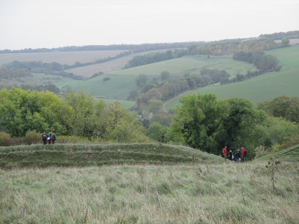
Hambledon is close by, just across a dry valley, perched high on a ridge, surrounded by the Neolithic, you feel like you’re flying when standing there. (blog post Archaeology SW day 2014, Hambledon Sunset)

Follow the Stour further south and you reach the triple ramparts and ditches of Badbury Rings on the Kingston Lacy Estate. From here you can see the chalk cliffs of the Isle of Wight (blog post Badbury and the Devil’s footprint)

Now from Badbury take the Roman road west to Dorchester and keep going beyond the county town, glancing at Maiden Castle as you pass(Duchy of Cornwall, English Heritage).

The Roman road continues straight towards Bridport but branches from the A35 road before you reach the village of Winterbourne Abbas.

It has now become a minor road.. a couple of miles on… it branches again..still straight but this once arterial Roman route to Exeter has dwindled to a narrow trackway with grass sprouting from the tarmac.

Don’t lose heart…keep going…and you will break out onto the chalkland edge and the multiple ramparts of Eggardon Hill.

From Eggardon, the other hillforts emerge as sentinals ringing the high ground overlooking the Marshwood Vale, and, to the south, the cliffs of Golden Cap.. and beyond, the sweep of Lyme Bay and the English Channel.

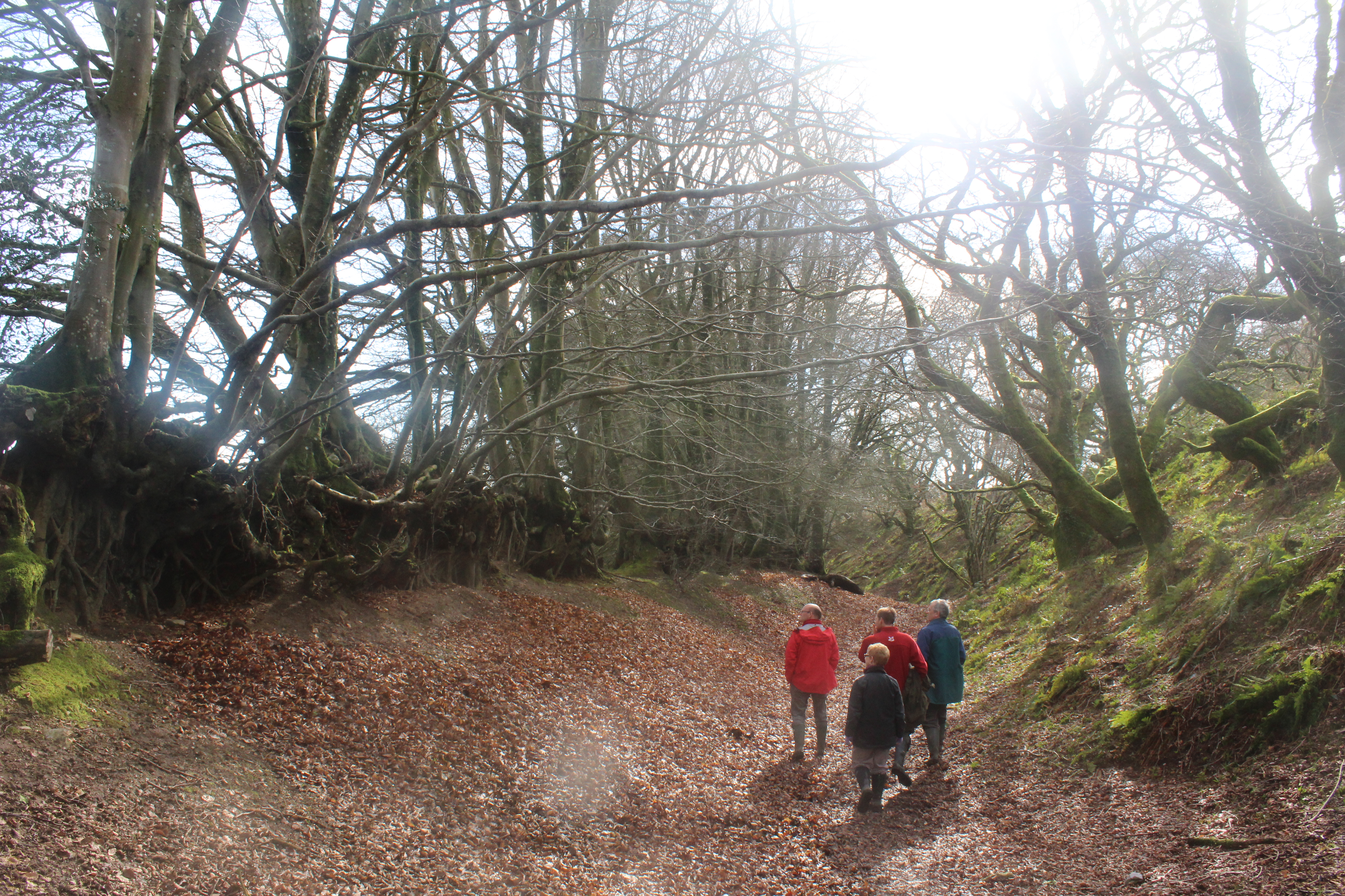
Winter woods at Coney’s Castle

Next to the west is Lewesdon Hill, a small fort but occupying the highest land in Dorset, nearby is the second highest, the flat top of Pilsdon Pen, surrounded by double ramparts and enclosing Iron Age round houses, Bronze Age round barrows and the pillow mounds of  the medieval rabbit warren.

The last two in the Project guard a gap through the Upper Greensand ridge at the Devon border. Coney’s Castle has a minor road running through it and on its south side are wonderful twisted moss covered oaks… and beneath them the deep blue of bluebells in the Spring. Lambert’s Castle was used as a fair up to the mid 20th century, remains of the fair house and animal pens can be seen there ….but once again the views are spectacular, particularly in early morning after frost with the mist rising from the lowland.

Lambert’ s Castle after frost.

A baker’s dozen of hillforts of the 59 the NT looks after in the South West.

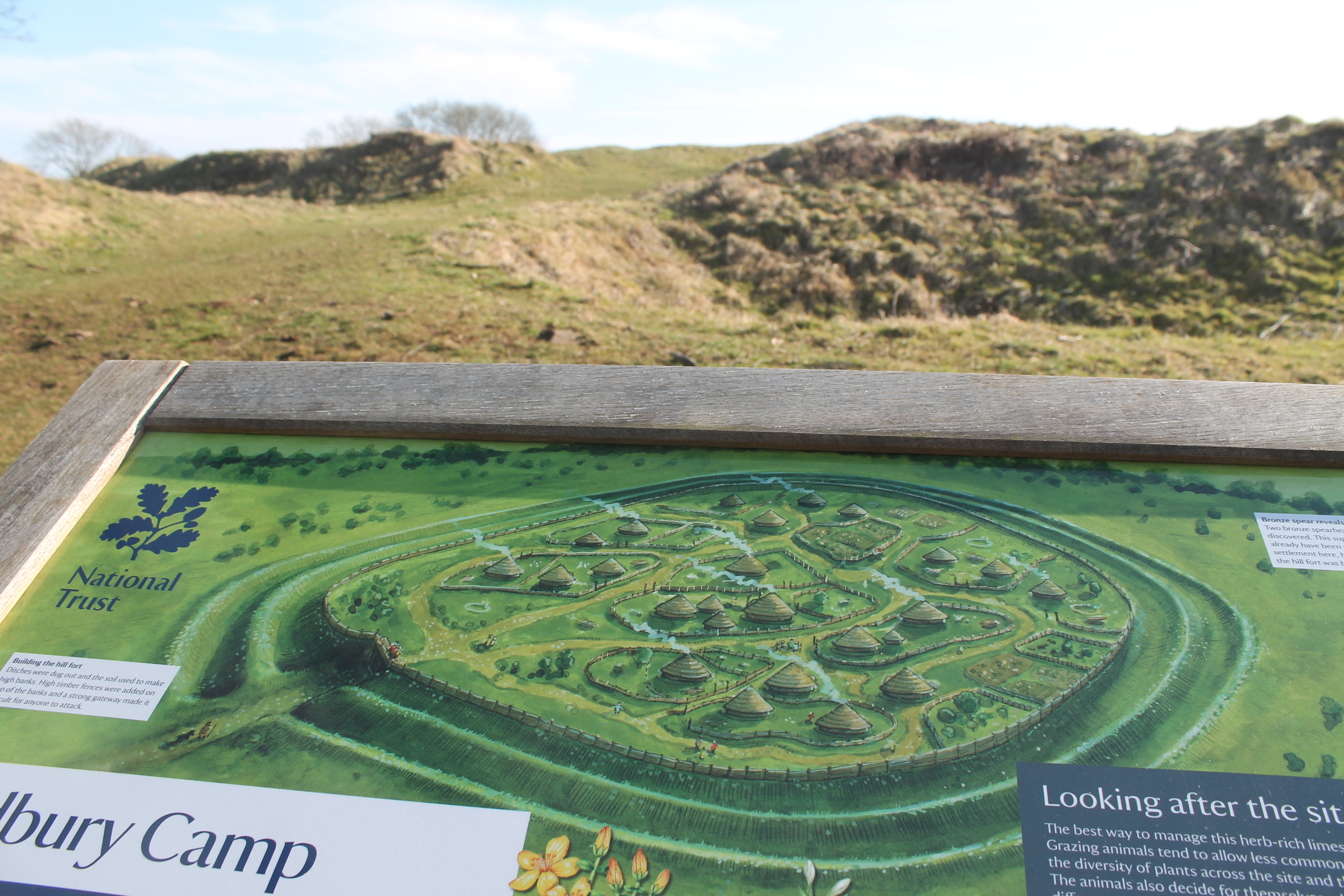
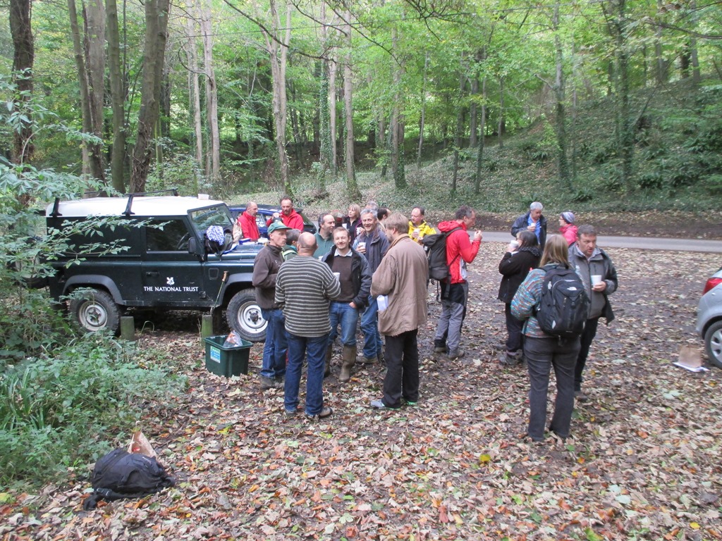
One might imagine that these huge works of humanity look after themselves… but they need to be cared for.. we must have farmers willing to graze the right number and type of stock on them….at the right times;  NT rangers and volunteers to cut regenerating scrub and fix fencing and gates…

If not, these nationally important scheduled monuments and SSSIs will deteriorate. The earthworks will become overgrown and grassland habitat will be lost, archaeological knowledge locked in the layers beneath the soil will become disrupted… and the views into the landscape and across and within the hillforts will become hidden.

The Wessex Hillforts and Habitats Project promises to be an exciting time of conservation and discovery. The work has now begun!

Back to Badbury

Reconstruction drawing of Badbury Rings, Dorset by Liz Induni for the National Trust

Reconstruction drawing of Badbury Rings, Dorset by Liz Induni for the National Trust

Yesterday I met Radio Solent’s Steve Harris in the car park at Badbury Ring, on the Kingston Lacy estate, near Wimbourne, one of Dorset’s many Iron Age hill forts. We headed towards the large banks and ditches of the fort as the nippy wind blew across the fields to cool our faces. As we walked across the Roman road and stopped to look at the Bronze Age burial mounds a Skylark rose into the air singing its soaring song.

Steve Harris with Badbury Rings behind him

Steve Harris with Badbury Rings behind him

Steve wanted to talk about the hill fort for one of his regular features on his show. He hadn’t visited the hill fort for a very long time so this was my que to show off all the wonderful archaeology under our feet. There are almost too many stories to tell, across the thousands of years of human activity in the area.

Excavating the ditch of a iron age round house, just inside the inner bank of Badbury Rings

Excavating the ditch of an Iron Age round house, just inside the inner bank of Badbury Rings

Apart from the obvious ‘humps and bumps’ of the Bronze Age barrows, Iron Age hill fort and Roman road, we have found evidence of the earlier use of the high ground the hill fort is on. When we excavated on he very top of the interior of the hill fort we found flint tools from both Mesolithic and Neolithic times.

One of the trenches in the interior of Badbury Rings hill fort. Each white tag is a worked flint or waste flake.

One of the trenches in the interior of Badbury Rings hill fort. Each white tag is a worked flint or waste flake

As Steve and I reached the summit of the hill we found evidence of a more modern use of the site, large concrete blocks with iron loops in the top. These were the remnants of fixings for a timber beacon tower which emitted a signal to guide planes back to Tarrant Rushton airfield a few fields to the west during WWII.

Next to one of these blocks we finished the interview and looked out across the landscape, cars traveling along the road between the avenue of Beech trees, people walking their dogs, children running along the banks, birds chattering and the memories of our excavations came flooding back to me. Was it really 12 years since we were here, finding a clay sling shot, part of a small twisted iron torc, and beautiful worked flint tools. I will return when the many and varied wild flowers are in bloom, so long Badbury,  till we meet again.

A very happy archaeologist in a trench at Badbury Rings with a large sherd of Iron Age pottery

A very happy archaeologist in a trench at Badbury Rings with a large sherd of Iron Age pottery

Cadbury Camp, Tickenham

The National Trust looks after 29 hillforts in Wessex (that’s Dorset, Somerset, Wiltshire and Gloucestershire in NT terms)

I suppose that’s not quite true NT looks after 27 and a bit, the north half of Eggardon Hill in west Dorset and the east half of Whitesheet, Stourhead Estate belong to other people. We care for only a bit of Wick Ball Camp, Dinton Park and just a rampart and ditch survives of poor old Burgh Walls near Bristol. The Edwardians built on the rest. Thank goodness Mr Wills gave NT Leigh Woods so that its neighbour Stokeleigh Camp didn’t suffer the same fate.

However, just a little west from Stokeleigh, along the Failand Ridge towards the coast at Clevedon, lies Cadbury Camp and the Trust looks after the whole of that.

The view from the west side of Cadbury looking south towards the Mendips

The view from the west side of Cadbury looking south towards the Mendips

This is not South Cadbury on the A303 near Yeovil nor is it Cadbury Congresbury also in Somerset. It is a lesser known but no less interesting place.

It is great to visit, quiet though close to Bristol and with panoramic views across the Bristol Channel into South Wales or inland towards the Mendips.

Cadbury Camp divided into 20m grids for our geophysical survey.

Cadbury Camp divided into 20m grids for our geophysical survey.

I visited recently and saw the work that the Bill the ranger has organised there. The double ramparts and defensive ditches have been cleared of scrub and it looks great. There is only one gateway, on the north side overlooking Wales and that’s the place where the only excavation took place. Harold St George Grey came here in 1922 and put two trenches in and found that the ramparts are made of limestone rubble, pottery finds were Iron Age but also Roman. In fact casual finds have included other Roman evidence including sandstone roof tiles and a Roman alter fragment with the figure of the god Mars carved into it. Perhaps there was a temple or shrine up here.

It’s a place that has been visited for a long time. Flints dating to the Neolithic period have been found here and in 1856 someone found a bronze spearhead about 3000 years old. A dog walker found another one a few years ago.

Harold St George Grey's 1922 excavation trenches across the entrance.

Harold St George Grey’s 1922 excavation trenches across the entrance.

Back in 2001, Bristol University carried out an earthwork survey on the south side of the hillfort because they spotted a blocked entrance there. Nick and I thought we would work with them and carried out a geophysical survey of the interior. It took some time but it is good to commune with a place and get to know it. I tend to get to know a hillfort quite intimately when walking up and down taking readings with a resistivity probe.

Somebody stopped to talk and mentioned that he had lived in the nearby village of Tickenham on the south side of the ridge since he was a boy. During WWII, the soldiers from the searchlight battery used to come down the hill and drink in the pub. They were part of the defence line around Bristol to stop the bombers trashing the aircraft factory at Filton. He showed us where their huts had been. The two Marks from the university carried on surveying the blocked entrance while I did the mag and Nick did the res.

Magnetometry, see the lines of the ploughing and the two blobs where we thing the searchlights were.

Magnetometry, see the lines of the ploughing and the two blobs where we thing the searchlights were.

When we downloaded it. The magnetometry didn’t show much just regular parallel lines, evidence of a period when the fort interior was ploughed and in addition lots of ferrous speckley bits along with two ferrous blobs. We concluded that this was where the concrete searchlight buildings had been. A subsequent meeting in Tickenham village hall gave us a clue to the speckles. Unexploded bombs which landed on Bristol were brought into the ramparts and detonated someone said.

The north-west part of the hillfort enclosure. Three parallel ditches. A Roman fortlet?

The north-west part of the hillfort enclosure. Three parallel ditches. A Roman fortlet?

The resistivity was interesting though. Three parallel ditches formed a playing card-like corner and used the north and west ramparts of the hillfort to complete the enclosure. The Roman finds might relate to this. It’s smaller but encloses the highest part of the fort. Seems a bit like NT’s Hod Hill in Dorset. Could there have been a Roman look-out unit here?

The new information panel at the north gate showing the Iron Age round houses that    people would have lived in over 2000 years ago...although we didn't see and ring ditches on our survey.

The new information panel at the north gate showing the Iron Age round houses that people would have lived in over 2000 years ago…although we didn’t see and ring ditches on our survey.

Meet us at Tickenham village hall on October 17th and we’ll show you round.

Steep climb to the wow!

It’s easy to take for granted the archaeology in the landscapes we work in, those special sites we can visit when ever we need to replenish our souls. All the archaeologists in the National Trust are spread across all the different places and landscapes in the Trusts holdings, each with a range of sites and wow’s.

Hambledon Hill

Hambledon Hill

We try to all meet up a few times a year to discuss common issues and share new discoveries and ways of working. The last gathering was down in Dorset here in the south-west, and we managed to do a whole day in the field, working on site management issues. The ‘fields’ we choose were  the adjacent hill forts of Hambledon and Hod. Two of the 7 and a half  hill forts we look after in Dorset. The climb up and down and up and down again was helped by a stop mid way for tea and biscuits provided by the Rangers who manage the sites and had joined us for the day.

A welcome break thanks to our wonderful rangers

A welcome break thanks to our wonderful rangers

As we reached the top of Hod Hill we got our first glimpse of the size of the ramparts and scale of the area inside them. Hod Hill even has room for a Roman fort in one corner!

Standing on top of one of the ramparts at Hod Hill

Standing on top of one of the ramparts at Hod Hill

Group exercise  on Hod Hill

Group exercise on Hod Hill

With colleagues from areas of the country that don’t have many hill forts or any at all,  commenting on how lucky we were in Dorset to have such magnificent monuments in our landscapes, I saw these sites with fresh eyes.

Stood on Hambledon Hill with Hod Hill in the background across the valley

Stood on Hambledon Hill with Hod Hill in the background across the valley

On the next sunny winters day do it, make the climb to the wow. Once on top of these hill forts you feel like a giant and you can touch the sky.

The snaking lines of ramparts, a giant sculpture from the Iron Age

The snaking lines of ramparts, a giant sculpture from the Iron Age

Hod Hill: Camp Bastion, Dorset

One of the two Iron Age gateways through the ramparts of Hod Hill. The largest hillfort in Dorset. Perhaps Ptolemy's 'Dunium'

One of the two Iron Age gateways through the ramparts of Hod Hill. The largest hillfort in Dorset. Perhaps Ptolemy’s ‘Dunium’

Yesterday, we walked along the rampart and I asked the group to stop at the gate and look back and imagine. Beyond Stourpaine, the Dorset landscape faded towards the coast and Poole Harbour.

This is where they had landed and below us the soldiers were arranged into companies ready for attack. The scouts on the hill top, spotted the target and signaled its range and distance to the artillery and then.. it started, awful twangs and whirrings as an avalanche of ballista fell on the chief’s house and compound.

At least, this was Sir Ian Richmond’s story when he excavated the compound in 1956. How else to explain the Roman ballista bolts embedded in the walls and floors of the two round houses there, all angled and pointed in the same direction.

There are no cemeteries or massacre deposits of the war-dead here, unlike Maiden Castle or South Cadbury. Perhaps dismayed by the initial onslaught, they opened the gates and let them in. The round houses were abandoned, piles of sling stones and spear heads were found, left in the cupboards by the front doors. Perhaps the conquerors told them to go at once and leave all weapons.

Hod Hill. Iron Age entrances bottom left and top right. Roman fort bottom right

Hod Hill. Iron Age entrances bottom left and top right. Roman fort bottom right

We walked on along the north rampart and came to the point where Iron Age hillfort defences are severed by the straight lines of the Roman fort. Built in the highest place, with 360 degree views, to the best military design. The ditches laid out to lure attackers into a killing zone. Within javalin range. Easy to enter, difficult to leave. A bank and ditch across the entrance to prevent direct assault and then the narrowing of the causeway to the gate.

Part of David Stewart's geophysical survey of Hod Hill. Iron Age entrance bottom right. Roman fort edge top right. Note the trackways radiating out from the entrance between the dense concentration of round houses. The numerous black blobs are storage pits. The small groups of four blobs between the tracks are probably    post-holes for granaries raised on stilts.

Part of David Stewart’s geophysical survey of Hod Hill. Iron Age entrance bottom right. Roman fort edge top right. Note the trackways radiating out from the entrance between the dense concentration of round houses. The numerous black blobs are storage pits. The small groups of four blobs between the tracks are probably post-holes for granaries raised on stilts.

Inside rows of timber barrack blocks in centuries, 500 men and then the larger long buildings cavalry units, another 300 mounted troops. The HQ building and hospital either side of the main road and across the way the houses for the commanders. The equestrian commander, of senior rank, had the bigger house (bit of friction there perhaps, Agricola mentions that infantry and cavalry often didn’t get on).

Here they were, 2000 years ago, in hostile territory. The nearest base about 10 miles away to the south. Bit like the wild west perhaps. Patrols, messages conveyed, supply trains attacked by the wild rebel elements.. perhaps. Who knows? The history is lost to us but from Vindolanda on Hadrian’s wall, we have rare letters that survive and from these we can imagine what it was like.

Where did these soldiers come from? A walk along Hadrian’s Wall is like a walk through the Empire. Each fort had a garrison from a different place but they carved the names of their cohorts on memorial stones. Perhaps from Spain or Syria, Tuscany or Gaul.

Hod hill is a great place to imagine, particularly in the Spring, particularly when the cowslips are out and the orchids are beginning to bloom.

Nick Skelton's illustration of Hod Hill from the National Trust's Dorset hillfort guide book. We have imagined the Roman fort established after clearance of the British settlement

Nick Skelton’s illustration of Hod Hill from the National Trust’s Dorset hillfort guide book. We have imagined the Roman fort established after clearance of the British settlement

Conservation Audit

A few years ago we carried out an archaeology audit for NT Wessex. We gave a significance grade for all the properties A* to D (we are renewing it this year).

There were some obvious top hitters, like the famous Wiltshire World Heritage site(s) but there were the other A* places like Whitesheet Hill on the Stourhead Estate and Brean Down jutting out into the Severn Estuary. Collections of concentrated archaeology spanning the Palaeolithic to the Cold War.

The Cottage in which Thomas Hardy wrote his first poems and novels near Dorchester

The Cottage in which Thomas Hardy wrote his first poems and novels near Dorchester

Many properties were acquired with no thought of archaeological significance but it is hard to find a place that has nothing worthy of interest. Thomas Hardy’s cottage near Dorchester is perhaps just another 19th century cottage, a new build on heathland. I try to grade it low but when a trench uncovers a scythe, a medicine bottle and a marmalade pot used by his family, there is suddenly a physical link to the great Dorset writer that is difficult to ignore (he wrote “Far from the Madding Crowd” here).

19th century debris, once used by Hardy's family and found during an excavation last year.

19th century debris, once used by Hardy’s family and found during an excavation last year.

As for Max Gate, the nearby house he designed and lived in later in life, the property is massively important. Not for the Victorian house (unless by association with the great man) but because it lies above a Middle Neolithic enclosure almost 5000 years old. It is one of the closest matches to the earthwork around Stonehenge. It was discovered in the 1980s when the Dorchester bypass was constructed and all that remains (over 50%) lies under Max Gate.

Snowshill in Gloucestershire, is also not known for its archaeology. It’s about a unique collection of stuff put together by eccentric Charles Wade in the early 20th century, but it occupies a medieval monastic lodge converted to a manor house.

Snowshill Manor. The site of Wolf's Cove lies on the left side of the main house.

Snowshill Manor. The site of Wolf’s Cove lies on the left side of the main house.

Snowshill was the last Conservation Performance Indicator meeting (see March 16th “Shall we Stack the Naked Acres”) for old Wessex this year. Strangely it was not held in the Cotswolds but in a wooden hut in Leigh Woods (just as nice).

Snowshill has a lost village called Wolf’s Cove which will be excavated this year. It will then be completely reconstructed based on documents and archaeological evidence.

Quirky and true to Snowshill’s spirit of place. Wolf’s Cove was a model village with canals, harbour and railway created and developed into the 1930s and then removed in the 1970s. It’s still archaeology.

Finished by lunch time, I was then released into the Spring. Leigh Woods is a fabulous place on the edge of Bristol. Purchased and given to NT over 100 years ago by the Wills family to prevent it being developed. It is fringed by grand Edwardian houses (a clue to what might have been) but it survives as a quiet haven.

The view across the gorge to Clifton hillfort from Stokeleigh. Brunel's famous bridge on the right.

The view across the gorge to Clifton hillfort from Stokeleigh. Brunel’s famous bridge on the right.

I asked Bill the ranger how the uncovering of Stokeleigh Camp was progressing and he told me about the work on revealing the outer rampart. I took my lunch and prepared myself for the view. On a day like this, with the fresh leaves all around, it was great to sit on the edge of one of the lesser known but massive Iron Age hillforts in the south west. I chose a good vantage point and looked down into the Bristol Avon Gorge towards Brunel’s Clifton Suspension Bridge. Stokeleigh is the best preserved of the cluster of three forts guarding the gorge. Burwalls Camp has been largely destroyed by a housing development and Clifton, across the gorge, has been partly built on and gardened.

A freestanding copy of an Iron Age roundhouse built within the hillfort in 2009 as part of the celebrations for  the centenary of acquisition. Newly cleared ramparts behind.

A freestanding copy of an Iron Age roundhouse built within the hillfort in 2009 as part of the celebrations for the centenary of acquisition. Newly cleared ramparts behind.

Stokeleigh Camp is a conservation success story. Let to another organisation for many years it became overgrown and difficult to see and understand. The NT took it back in hand. In the last few years, the rangers and volunteers have returned it to woodland pasture leaving only the ancient pollarded oaks. No good clearing scrub from a site without grazing. A higher level stewardship scheme has provided the funds to introduce a few Red Devon cattle that keep the regrowth down. The place is now as it was in the early 19th century, when artists would come out from the city and sketch the landscape from the ramparts.

“Shall we stack the naked acres with our CPIs”

March and April are the CPI months. The National Trust is a unique British organisation set up in 1895 to conserve places of historic interest and natural beauty. How do you do that? How can NT measure how successful it is? Where should it spend its limited resources? Is a Joshua Reynolds painting in a mansion more important than an orchid on the ramparts of an Iron Age hillfort? The answer is… the Conservation Performance Indicator (CPI).

Picture a room with a table, a powerpoint projector and a circle of chairs: perhaps a cafe on the Somerset coast or a barn in Dorset or even an old engine shed in Somerset. The players take their seats. The ecologist, the curator, the building surveyor, conservator, gardener, ranger, manager and…archaeologist. The main conservation features of the property are agreed and then three lists are made and the match begins. Which is most significant, which would have the greatest conservation impact if lost and which requires resources most urgently. For some places the top points are easier to allocate than others. Stonehenge landscape has archaeology at the top but what of the Stourhead Estate in Wiltshire.

Stourhead Lake and Pantheon aquatic archaeologists from NAS prepare to dive

Stourhead Lake and Pantheon aquatic archaeologists from NAS prepare to dive

Is the famous 18th century landscape garden with its grade I listed temples, lakes and bridges more important than the incredibly rare Pope’s cabinet in the house or does the scheduled Early Neolithic causewayed enclosure on Whitesheet Hill rank higher than the SSSI chalk downland sward that covers it ? (well, they tend to be mutually beneficial so taking care of the ecology generally benefits the archaeology).

Whitesheet Hill, Stourhead. A Bronze Age burial mound (c.2000 BC) above a causewayed enclosure (c.3600 BC)

Whitesheet Hill, Stourhead. A Bronze Age burial mound (c.2000 BC) above a causewayed enclosure (c.3600 BC)

Then ideal conservation objectives are set for each feature and actions are agreed which after 12 months will be scored depending on how much has been achieved. This is a good time to meet conservation colleagues and work together on integrated conservation management. This week the CPI scores for Kingston Lacy (Dorset), Stourhead (Wiltshire), Tyntesfield (Somerset) and Purbeck (Dorset) have been decided.

Wet Badbury

Wet Badbury

Everywhere’s so wet at the moment.

Here is a picture I took last week of the eastern ramparts of Badbury Rings, located at the centre and highest point of the wonderful Kingston Lacy Estate in Dorset.

This is one of over 40 Iron Age hillforts cared for by National Trust in the South West. Each one chosen over 2000 years ago (not by NT, it’s only 118 yrs old)for its strategic location, as a place to live and defend. Amazing to think of the effort it took to dig deep ditches and heap up ramparts. There are three rings of these fortifications at Badbury.

Hillforts are great places to visit. Each perched on a hilltop or headland with lovely views across their surrounding landscapes. Imagine those who have been there before you.

The ground is soft and muddy. Winter is when the NT Rangers tend to carry out conservation work on ancient monuments. Cutting scrub and mending erosion scars. Even light vehicles cannot be used to mow the bramble and cut undergrowth in these conditions.

Even footfall can start to wear away the precious archaeological soil and affect the potential stories of past lives locked beneath the grass.