R3: Wendover to Watlington: Pulpit Hill 17.5 miles

We walked out of Wendover at 9.30am.

Emma looked around ‘I don’t think it’s real. The whole place will probably dematerialise when we cross the railway bridge’

‘What do you mean?’

‘Well the information board was upside down’

‘True.. and the people…All larger than life, the ancient waiter and the eccentric landlord.. the disturbance in the bar and the police.. perhaps we were in a game of Cluedo or a late 60s episode of the Avengers’

Wendover disappeared behind us as we turned left and we started the slow trudge up to the Ridgeway.

The wide views again and a monument at the highest vantage point. A large stone structure erected in 1903 in memory of those who died in South Africa during the Boer War.

The Boer War memorial above with views north towards Aylesbury

There are few archaeological sites associated with this conflict but Bath Skyline has Flatford Camp, a military training barracks set up in 1892. It is shown on the 1904 OS map but on no other editions.

1904 2nd edition OS map showing the Boer War training camp on Rainbow Wood Farm, Bath

Our path took us down through deciduous woodland. The sky overcast, the trees brooding… no dappled light today.

We reached the National Trust property of Pulpit Wood and Grangelands.

Reconstruction drawing of Pulpit Hill hillfort on the NT property website.

Above us, hidden by trees, was a later Bronze Age – earlier Iron Age small hillfort on the brow of Pulpit Hill. Double bank and ditch around its east and north facing edges; univallate to west and south, where the slope of the hill is much steeper. A single clear entrance on eastern side, where the ground is flat. The need to control access along the Ridgeway was clearly important.

‘How are we doing’

‘Average speed 4.6km per hour and we are approaching the 5 miles out from Wendover’

‘Where?, you know, that mirage we stayed in last night’.

Our path followed a row of security posts across a field with some battered signage on each one saying it would be wrong to cross the sign line into the wheat field on our right. It warned of security cameras (It all looked a bit low tech to me). We walked across an entrance drive behind the security gates for Chequers, the Prime Minister’s country retreat. I spotted the great house in the distance.

The Ridgeway path crossing the entrance drive to Chequers

I thought it was quite British… and understated… that Boris and Biden might screech to a halt to let a couple of Ridgeway walkers pass by before international negotiations.

This is an AONB after all… and barbed wire, searchlights, high fencing and armed soldiers would certainly detract from the aesthetic experience of the National Trail.

Our walking banter was of English sayings. ‘You wouldn’t look a gift horse in the mouth’

‘What’s that mean anyway?

‘It’s linked to ‘Too long in the tooth’

‘Really?’

‘You know… when you buy a horse… you always look in its mouth to see how old they are based on the length of their teeth.’

‘Oh’

11am, we crossed a road and bumped into a public house. Extraordinary! How perfectly timed.

‘Well, you wouldn’t look a gift pub in the barrel, particularly if you just wanted a cup of coffee and one of those nice biscuits’

This was a useful rest as there was a steep climb through woodland after the pub. I said to Emma that it would be a shame if I just went bang. She thought it would be a shame and perhaps a little awkward.

Up, up onto Whiteleaf Hill with a great scenic view over Princes Risbororough beside a mutilated Neolithic earthen long barrow.

There were so many Red Kites. We counted a group of 15 circling (we’d run out so they introduced some from Spain a few years ago….they’ve done everso well).

We walked down towards the town. A little muntjac deer emerged from cover and watched as we passed.

We took an erratic course along a minor road, across two railway lines and a golf course.

Everywhere much quieter on a week day. Just the odd dog walker.

At the crest of another hill, at one o’clock, I checked in with Emma for a progress report.Half way, 8.7 miles, our speed average 4.65km per hour and a miraculous Ridgeway seat appeared. We sat on it to see yet more Red Kites wheeling in the sky.

Lunch time Ridgeway seat.

We were ready to consume the wonders we had picked up in Tesco Express. Ginsters pasties regular and vegan and easy peelers. Today’s top tip is to always buy the best because dehydration when walking is a thing and an easy peeler bursting with clementine juice is a huge jolt after a long morning.

This luxurious lunch break has lulled you into a false sense of security.. because…. in fact.. there was jeopardy pent up and ready to strike as the day progressed towards its end.

Last night, the forecast had been one of continuous rain storms building from the east and the further we got from London…. by late afternoon… the better.

The meander stopped and we did a left onto the Swan Way that headed straight south west for 5 miles carrying us to our destination…. Watlington.

We pressed on… the sky increasingly gloomy. The tunnel under the M40 framed nicely the landscape beyond, then through some woods, and suddenly, a violent commotion as a sausage shaped animal with a black tail-tip leapt across our path to disappear into the undergrowth on the other side. ‘Stoat’ we said… a rare glimpse.

The Ridgeway sign near the M40

Then it rained and we changed into water proofs and it stopped and we got hot so took them off again and then it rained properly….so they went back on…. as we left the path and walked the mile into Wattlington. Emma googled the pub….. it was closed… but there was a note on the door directing us to our rooms. Phew, we had made it.

Ivinghoe Beacon to Cley Hill: Walking Home

Back in 2018, I persuaded my daughters Kate and Emma to walk the Cotswold Way with me and wrote of our encounters in this blog… describing the National Trust archaeology we travelled through from Chipping Campden to Bath.

It’s been a long time and I wonder whether I can still hack it. Put on the rucksack and walk across a bit more landscape.

Kate and Josh accompanied me on a trial run along the South Downs a couple of weeks ago… from Eastbourne to Hassocks. Things held together and we made it. They’ve flown off to Italy now.

The view from Beachy Head to Birling Gap

It was touch and go… but Emma cleared her commitments and agreed to be my companion once more.

This time we’re walking home. Take the train to London, to Tring and then up onto the Chilterns.

To begin at Ivinghoe Beacon and treck130 miles along the Ridgeway to Cley Hill..

We’ll be trespassing on National Trust London and South West Region territory for a while.

Before we cross over the border into Wiltshire again.

If we hold out… I will see the Uffington White Horse.

An amazing prehistoric chalk artform. It will feel good to earn my first glimpse of it by walking (as with Hadrian’s Wall on the Pennine Way).. and then on to Avebury.

I have closed and locked the office in Tisbury, left the gathering driftwood of emails to accumulate..

The years are too few. England must always be appreciated in the Spring.

This walk through bright new woodland, multi-hued greenery, fields of orchids and buttercups ..to the heart of the west country ..will be an absolute pleasure.

whatever the weather throws at us…. but I do hope the Ridgeway will be kind..

Loveliest of trees, the cherry now
Is hung with bloom along the bough,
And stands about the woodland ride
Wearing white for Eastertide.

Now, of my threescore years and ten,
64 will not come again,
And take from seventy springs 3 score,
It only leaves me twenty more.

And since to look at things in bloom

Twenty springs are little room,
About the woodlands I will go
To see the cherry hung with snow.

A.E. Houseman

Dyrham LiDAR 2

Dyrham House from the statue of Neptune above the park.

Last time, I wrote about the way the aerial scanning of the ground from a plane can produce high resolution digital terrain models which can reveal patterns of faint earthworks. These are impossible to see through aerial photography or visually on the ground, even in low sunlight.

I also mentioned the way that tree cover could be filtered out to see just the ground surface beneath the trees.

LiDAR is short for Light Detection and Ranging and these digital images are best interpreted by comparing them with other layers of information.

Modern digital mapping allows different imaging sources to be superimposed and by using percentages of transparency, the chronology and phasing of earthworks revealed by LiDAR can be better understood.

I will do this by using the LiDAR that the National Trust commissioned for Dyrham Park. A property which lies between Bristol and Bath in South Gloucestershire.

The LiDAR survey of Dyrham Park. The site of the mansion and West Garden lies at the bottom of the valley centre left. The lines of old medieval open field strips can be seen middle right

Briefly, Dyrham is a landscape park occupying an amphitheathre of natural terrain with the great late 17th century mansion occupying the valley floor beside a medieval church. The church demonstrates that manor houses have occupied this favoured spot since the Domesday survey of 1086. Archaeological fieldwork has demonstrated that there has been significant Roman and prehistoric occupation at this location.

LiDAR plot zoomed in to central area of the park. The Old Lodge area middle right.

The LiDAR plot of the whole park shows that the deer park here was enclosed out of a medieval open field system and that no cultivation has taken place for over 400 years. The plough ridges, arable strips and furlongs remain from the last year of ploughing frozen in time.

The farm buildings in the centre of the park have structures dating to the later 18th and 19th centuries shown on the modern aerial photograph.

A modern air photo of the ‘Old Lodge’ farm buildings within the park

However, if you upload the LiDAR and fade out the photo you can see that the present buildings do not relate to earlier earthworks though there is a focal significance to the area in which the buildings stand.

Air photo faded to show LiDAR earthwork detail beneath

Notice the three broad linear features radiating out from this place, a little above where the present buildings stand. These must be quite old as these linears are cut across by trackways and other features.

A 17th century map shows an earlier lodge near this location. This was the keepers house built at the division between the rabbit warren to the upper left and the deer park to the right.

Another layer to be georeferenced and compared with the LiDAR would be a geophysical survey which would show how vague surface earthworks might relate to anomalies detected beneath the ground.

Another quick comparison would be to compare historic maps with the LiDAR. Here the 1921 edition of the Dyrham Ordnance Survey maps is made transparent above the LiDAR. Notice how the trackway heading from the buildings continues towards the top centre respects a large rectilinear earthwork but does not show what it is.

The next slide shows the 1892 OS map over the LiDAR. In less than 30 years the size of changes can be seen. The site of the aviary is not shown in 1921 and in 1892 the enclosures surrounding the farm buildings were more extensive.

So the basic data of the LiDAR provides a great insight into the historic earthworks of a piece of land but it takes time to test them against all available sources and sift out the potential information that might lie there.

The Stourhead LiDAR

Whatever next?

When Archaeology takes advantage of new techniques, whole new landscapes of information emerge.

One of the most exciting developments in recent years has been Light Detection and Ranging or LiDAR for short. Using a drone or an aircraft, pulsed light signals are sent using a laser. When linked to a scanner and a global position system (GPS), It can create an ultra-fine 3D record of the ground surface over wide areas.

The boundary of the National Trust’s Stourhead Estate in South Wiltshire. Whitesheet Hill is on the edge top right. Stourhead Park and mansion, garden, lake and Stourton village are lower centre. Park Hill Camp hillfort lies in woodland centre left.

In large surveys, millions of light points are plotted and tied to existing mapping with the GPS. Each point has its unique XYZ position… latitude, longitude and height above the datum level.

The total Stourhead survey area tilted slightly to show the contours covering roughly the same area as the map above. Whitesheet Hill on the right The hillfort faintly visible on the lower right hand edge. To the left, two valleys separate a ridge which has Park Hill Camp hillfort near the middle.

The Environment Agency has been using this technology for years and have made their data freely available. A quick visual link can be seen here https://houseprices.io/lab/lidar/map. This survey data was collected mainly to predict levels of flooding and consequently it tends to be concentrated along valleys and coasts. It has given good results but the detail tends to be at 1.0m resolution or in the better areas 0.5m. The best quality is 0.25m density of coverage.

There are still large gaps in the land area currently covered by LiDAR and therefore the National Trust is commissioning its own surveys at 0.25m.

In the South West, there are new surveys for the Bristol and North Somerset properties, the Bath and Dyrham properties and most recently the data has arrived for the Stourhead Estate in South Wiltshire. Bluesky collects the data and it is analysed by ArcHeritage who provide the baseline digital imagery in various forms as well as the core GPS files.Their report picks up many new sites which have now been uploaded onto the NT Historic Buildings Sites and Monuments Record. This is not the end: new archaeological sites can still be discovered by further manipulation of the data combined with other information sources.

The LiDAR data can be uploaded into the digital mapping system and then it can be overlaid as a layer on digitised historic maps, onto geophysical surveys and onto aerial photographs. It is so easy these days to zoom in an out of maps and also to fade one layer of information and then see another in direct relation to it.

Detail of Whitesheet Hill causewayed enclosure. Four round barrows can be seen along its bottom edge all with little dimples in the top where the owner of Stourhead Estate, Richard Colt Hoare, excavated them in he early 19th century. One at the lower left hand edge of the plot was cut by a chalk quarry in the 19th century. Close examination of the plot shows phases of trackways and faint embankments.

A great ability of LiDAR is to fell forests and woods (virtually) to see the ground surface beneath. Something impossible with air photography.

Imagine the light pulses from the aircraft like rain falling on the ground. Some will bounce off the tree tops (the first returns) but many will hit the ground below the tree canopy (the second returns). There are systems to filter out the first returns so that only the ground can be seen. It is why I always ask for surveys to be done in the winter when the leaves have fallen from the trees and the ground surface can be most clearly surveyed.

Park Hill Camp from the air surrounded by conifer plantations. In the last 10 years the National Trust has gradually removed the trees from the scheduled monument. The LiDAR defines the earthworks in a better way than can be seen by aerial photography when trees interrupt the view (see below)

Stourhead’s Park Hill Camp Iron Age hillfort has been covered in trees for many years making it difficult to see. Over a number of years, gradually, the National Trust has been clearing the woodland and bringing it back to grass. The LiDAR survey has enabled the ramparts and ditches to be clearly seen as well as showing its strategic position on the ridge top unimpeded by the conifer plantations that surround it.

The ramparts and ditches of Park Hill Camp Iron Age hillfort revealed by the LiDAR survey.

Another great thing: the LiDAR light point cloud is three dimensional and this enables a digital terrain model to be created. This can be viewed on its own or it is possible to drape aerial photographs and/or historic maps across it…as though the map or photograph has become a gigantic cloth thrown over the contours of the landscape. There is now the ability to screen- fly through the Stourhead landscape switching on or off other layers of information while weaving up the valleys or skimming over the hillfort ramparts.

Stourhead Lake (bottom) and the position of Park Hill Camp Iron Age hillfort clearly revealed on the ridge top between two valleys. This area is planted with trees and this vantage point of the fortification would not normally be appreciated.

During a bright winter day, low sunlight will traverse the landscape bringing different shadows in sharp relief and revealing new details. LiDAR analysis can introduce its own light source and the survey plot can be re-generated.. with the light source at any angle and direction. This shows up very faint archaeological earthworks when the light source is beamed from a particular direction.

The LiDAR survey shows the quality of surviving archaeology and reveals where conservation should be concentrated across the Stourhead Estate.

This image looks down to the arable land from the hillfort and causewayed enclosure on Whitesheet Hill. On the lower land, the earthworks have been almost levelled by modern ploughing but old quarries can be seen clustered, where stone outcrops on a low hill, and faint traces of prehistoric ‘celtic fields’ can be seen.

The Stourhead farmland, ploughed for many 100s of years, has lost much of its archaeology but the survey still shows traces of medieval and prehistoric agriculture and traces of buried enclosures suggesting settlement remains below the ploughsoil….(though much worn down buried pits and ditches will survive).

However, there is fine earthwork survival in Stouhead Park and on Whitesheet HIll.

The prehistoric earthworks on Whitesheet Hill show up very clearly: the Iron Age hillfort to the south, the Neolithic Causewayed enclosure in the middle and the other enclosure (also probably Neolithic) to the north and in between Late Bronze Age cross ridge dykes, Early Bronze Age round barrows and medieval pillow mounds all crossed by banks, trackways and quarries of various periods.

Whitesheet Hill: LiDAR shows the ramparts and ditches of the Iron Age hillfort (c.300BC) at the bottom. The three rectangles are modern reservoirs just east of the National Trust boundary. A cross-ridge dyke (c.1000 BC) divides the narrow downland ridge separating the hillfort from the Neolithic causewayed enclosure (c.3600BC) which has a Bronze Age round barrow (c.2000BC) built over its southern edge and across its north side runs the old cattle drove road from the the west towards Salisbury and then on to London. Further along the down to the north (the upper edge of the plot), is another faint enclosure (c.3000 BC) of similar size to the causewayed enclosure (this site has been ploughed in the 20th century but can be seen clearly on the LiDAR).

The parkland is a very precious survival. The ridge and furrow of medieval open field furlongs was fossilised when the park for the mansion house was created. This must have happened before 1722 which is the date of our earliest map of the park.

The 1722 Stourhead Estate map (Wiltshire and Swindon Record Office). The newly built Stourhead House is centre right. The north-east corner of the park is Spencers Mead. The strip fields and curving enclosure ditch shown on the LiDAR lie within this field and Slade Mead below. Buildings in red between these fields were demolished in the late 18th century, the building sites lie where there are earthworks shown on the LiDAR image below.

Near the Stourhead House and near the landscaped garden obelisk are two turbulent areas of earthworks, outside the areas of agriculture and therefore places already occupied ….before the open fields were created it seems.

One of these, east of the House, is likely to be the site of the medieval Stourton Castle..demolished when the present mansion was created in the early 18th century. The other area near the obelisk is a mystery… the LiDAR raises many new archaeological questions…. wonderful.

Next year the Cotswolds and Hidcote NT properties will have LiDAR We await the results with anticipation…what new Roman sites lies beneath Chedworth woods……

The site of the present Stourhead House is lower centre. The buildings show as triangles. Top right is the NE corner of the present park where a large oval enclosure (prehistoric?) underlies the regular furlong blocks of strip fields divided by trackways (this is just grass not visible on the ground). Centre right and NE of Stourhead House is an area of earthworks likely to be the site of the medieval Stourton Castle. At the left edge of the picture is another grouping of mixed earthworks, perhaps an early settlement to the right of the mound with the 18th century obelisk monument on it.

Cotswold Way 8 Tormarton to Bath, the final leg. (Dyrham and the Assembly Rooms)

We’re coming home, we’re coming home…

A group hug as we left the hotel, the last leg of our walk along the Cotswold Way.

Kate, Emma and I needed to be at Bath Abbey by 5pm.

When asked, the receptionist said that there was a shop at Cold Ashton …so we would lunch there.

We walked through the village of Tormarton, over the M4 bridge and across farmland. There were freshly repaired drystone walls all around us. We met the wallers with their timber templates … building as we passed by.

WP_20180529_007

The dry stone wallers near Tormarton

Dodging the cars on the A46 crossing, we walked through the pasture fields down to Dyrham Park. Through the village… where I picked up and handed Emma the third find. A fragment of Tudor earthenware churned up in the verge. A side track took us to Dyrham House where I met Tim coming out of the property office.

WP_20180529_010

Walking towards Badmington Doors: The NW corner of Dyrham Park

I thanked him for showing me the cellars the last time we met.

I had often wondered what survived of the earlier Dyrhams. Tim had shown me that down a flight of stairs, under the present house are flagstone floors and the quoin stones of the Tudor house, once occupied by the family of William Blathwayt’s wife Mary.

WP_20180529_015

The view from the Cotswold Way into the West Garden of Dyrham. Newly restored c.1700 garden bed as shown on Kips view of 1700.

William was Secretary at War to William III and had sufficient funds, in the 1690s, to organise a complete rebuild of Dyrham.. in the fashionable Baroque style. He also had the park laid out as a Dutch-style water garden. It had a long canal fed by a high cascade plunging down from a pool on the escarpment edge.

We opened the door and walked into the large orangery which lies beside Dyrham House. There was a large print of Johannes Kip’s perspective view of the finished intricate garden. Drawn in 1712, it shows the newly finished gardens with their patterned beds, fountains and ornamental garden buildings.

Looking back from the orangery towards the Cotswold escarpment, Kip’s drawing is hard to believe (though where we have excavated…. the drawing has proved true). A green amphitheatre now, reworked in the late 18th century, but the pool and the Neptune statue survive to mark where the cascade once fell 50 feet into the canal.

The dry weather is gradually revealing the hidden walls in the east park. The ground dries out more quickly where there is buried stone.. with less depth to conserve moisture. Parched lines of dry grass show what lies beneath.

Dyrham Park is covered with earthworks and the National Trust has just commissioned a LiDAR survey for whole property. This fine laser scan of the property’s ground surface has revealed the time depth of the place, which dates back to the Roman period and beyond. Such a good place to live and build a house. The medieval parish church stands beside Blathwayt’s rebuild to demonstrate that a medieval manor house once stood here. Just like at Horton Court which we had walked past the previous day.

Paul, Dyrham’s archaeologist, has been working in the east hall of the house, below the Cedar staircase. Under Colonel Blathwayt’s marble flagstones of the 1840s, were timber floorboards and below these a void. Down in the cellars was a breeze block wall, placed there when the heating went in about 60 years ago. A few blocks were removed and we peered through to find a well-dressed limestone wall and a stone corbel of later medieval style.

WP_20180427_034

The blocked cellar below the Cedar stairs

We walked further into the cellars across a gushing stream conduit to find a structure with a spiral staircase leading nowhere and a window looking out into the dark.

There have been manor houses at Dyrham at least since the Saxon period and our new discoveries, in the cellars, demonstrate that there are remains from at least the 15th-17th century to be teased out by mapping the house at this low level…..

Kate, Emma and I could only afford a brief rest before moving on…. as it was already mid morning. We walked back into the countryside and were soon within woodland. A little way in, we came across a bench and beside the path a wooden box..and in the box a plastic tub and in the tub a note book and pen….left by the Cotswold Way association

WP_20180529_019a

The bench and box in the woods.

Our chance to record for posterity (or at least until the book was full) that we had reached this far…to leave a message for our Australian and American compatriots who started the walk with us at Chipping Campden. We signed the book and wished them well. The wild garlic in the wood was fading and we remembered the garlic’s rich aroma and sea of white flowers near Snowshill. How quickly things change.

We were heading for Pennsylvania, a hamlet with an unlikely name on the A46. Most importantly, it had a garage with a coffee machine and snacks. We sheltered behind a sign as the refueling cars pulled in. A surprisingly cool wind and my hayfever seemed to be developing into something more significant.

A mile beyond the road was Cold Ashton. A ghost hamlet, not a person in sight and certainly not the shop promised by the Tormarton receptionist. A bench with a view and time to search for whatever remained for lunch in the rucksacks. This amounted to an emergency bag of dry roasted peanuts and two crushed Wispa bars which had been carried for 95 miles ……for a time such as this.

We feasted and moved on.

Our next destination Lansdown Hill. A long climb. Then the text noise on the phone went off. Jan said ‘when will you get there?’

WP_20180529_033

One of the information boards on Lansdown Hill.

We were confident.. 4.30pm. Time for Jan to catch the train from Warminster and meet us at the Abbey.

On Lansdown Hill we reached a battlefield… Pennants and boards marking the positions of troops. 5th July 1643. Old peace-time friends Lord Hopton (for the King) and Sir William Waller (for Parliament) fought it out above the downlands of Bath. Waller held the City and Hopton led an army which was marching through the West Country seizing any outposts of Parliamentary strength that remained.

A pitched  battle between thousands of cavalry, musketmen and pikemen. Significant losses on both sides but in the end Waller continued to hold Bath and Hopton retreated to Devizes. The information boards tell of the ebb and flow of the battle… amongst the sound of skylarks.

The path over Lansdown took ages and we got lost in a golf course again. The time ticked by and there was no way we would be there by 4.30pm. Finally the City was below us and we were descending into the outskirts of this Georgian World Heritage Site…. overlying Roman Aquae Sulis, centred around a bathing and religious complex because of its magical hot water spring.

We started at the National Trust Chipping Campden market hall and we would finish close to the Bath Assembly Rooms, owned by the National Trust since 1931. It is now leased as a fashion museum by Bath & NE Somerset Council. This was a place mentioned in the Jane Austen novels ‘Northanger Abbey’ and ‘Persuasion’. Designed in 1769 as place for fashionable Georgian society to meet, dance and play. Austen describes one of the main functions of the place… for mothers to bring their unmarried daughters in the hope of finding an eligible husband (with loads of money).

The place declined in the 19th century but following work by the Society of the Protection of Ancient Buildings and NT….it was fully restored by 1938… but not for long. One of the bombs from the Luftwaffe raids on Bath 25-26th April 1942, hit the building and it became a burnt out shell. Nothing was done for years but it was finally restored and opened again in 1963.

Inspired by the discoveries at Dyrham…. it would be good to find time to look in the cellars and see whether there are remains of medieval and Roman Bath hidden down there. A visit to the Roman Bath complex near the Pump Room and Abbey demonstrates what lies hidden under the City.

WP_20180529_042

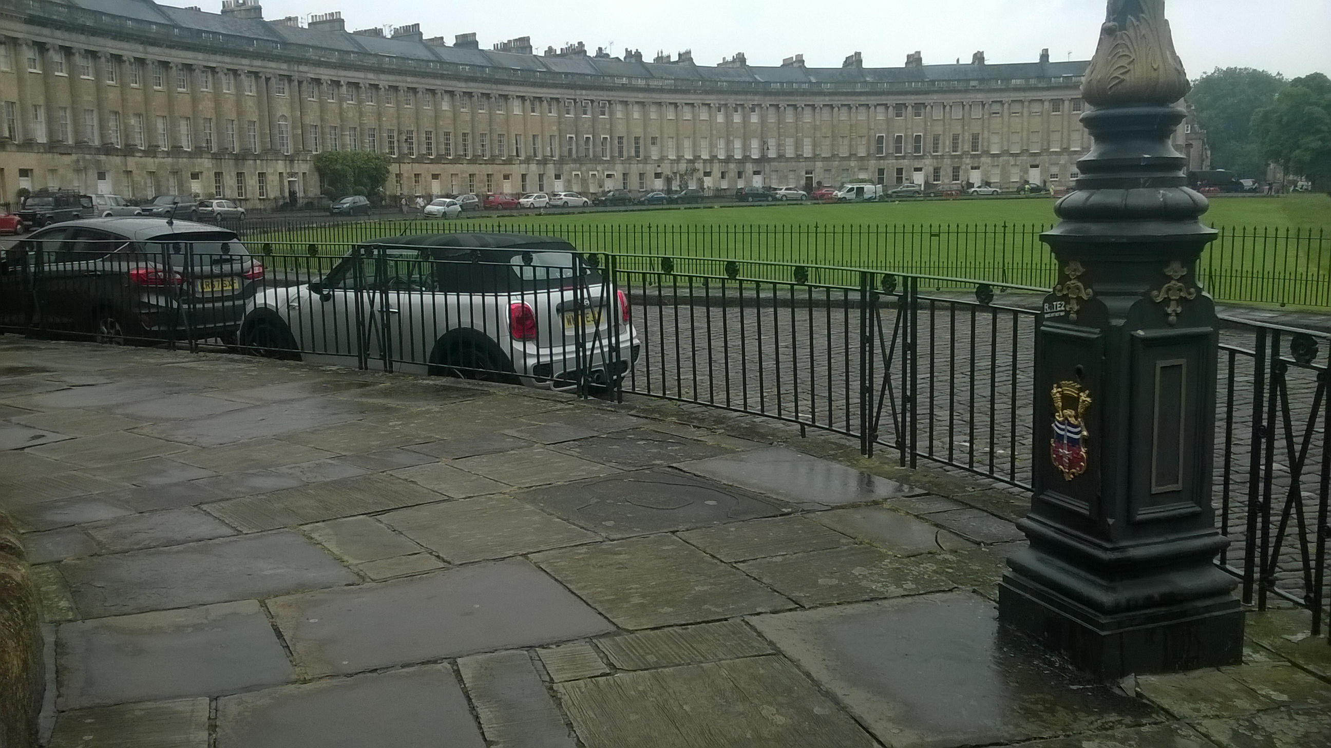
The Royal Crescent Bath

Jan texted again ‘Where are you ?

‘We had walked all day…beginning at 8am on the wrong side of the M4. Kate told us 5pm was the deadline to complete the walk. She needed the train to London.

Now, weaving through the smart, city-busy shoppers and tourists, our goal seemed unlikely to achieve. Then, the Royal Crescent and Circus were behind us. We headed for the Pump Room and Baths …it might be possible. As we approached the Abbey Tower the mechanism was whirring. ‘Come on Kate!’ I touched the stone as it struck one, Emma at two. Kate pulled a face.. paused… and touched on the stroke of 5.’

Jan was there waiting for us and we went straight to the station. Kate slipped into something more civilised, got her train and left for London. A couple of days later Emma took the plane for Milan from Bristol Airport.

Had I become a lean hardened walker? One of my aims was to become fit again…after so much time at a desk writing emails. Too many large breakfasts and relaxed evening meals had counteracted the 100 mile benefits of the walk ….and now my hayfever had shifted into a cold, turning into a hacking cough….then my back seised up in protest.. but after a couple of days of rest….

What would be my final Top tip be for you.

Block out two weeks next May and/or June and just do it. Life is short and the cycle of English flowers will not wait for you.

Hand-pick a good companion… or just go on your own… you will meet people out there.

Now…. I must pack the car full of tools and drawing boards, measuring tapes and files …and tomorrow head for Chedworth Roman Villa.