
This blog series seeks to link the experience of the Cotswold Way with the line of National Trust properties which it threads through. It also offers top tips to any potential walker planning to embark on this National Trail.
Today’s top tip is: plan your walk so that it is divided into roughly equal day long lengths and to choose accommodation close to the line of the long distance path.
The day 5 stop was disappointingly close to Painswick and a couple of miles away from the footpath. It was booked in the mistaken belief that it was in Kings Stanley rather than on the north side of Stroud.
I explained the miscalculation to my companions Kate and Emma and tried to paint a bright picture saying that it would mean we would arrive early at the B & B that day. The flip side was that on the following days of the walk the distances would be …a little longer.

Painswick town is very pretty. We walked out of it in light misty rain but nothing worth putting on waterproofs for.
Soon we found a field with a stone pillar in it. On one side was Chipping Campden 47 miles and on the other Bath 55.

This is an area full of National Trust properties. The Stroud Commons: Minchinhampton Rodborough, Boundary Court. Today we would pass through Cotswold beech woods the National Trust’s Mansfield Wood and Stockwood and then Haresfield Beacon, Shortwood and Randwick Wood.
The trees were tall and slender, misty and a little sub tropical. They reminded me of the New Zealand native bush. I mentioned this to Ron and Sue from Queensland when we bumped into them again deep in the woods… but they were not impressed. No chance of bumping into flights of terraced Maori kumara pits in Gloucestershire… but it had that feeling… that suddenly a fantail would flit out of the dark and rest on a branch beside me.
At lunch time we climbed up from a farmyard and reached the end of the Iron Age hillfort of Haresfield Beacon. Although mist shrouded there was still a hazy distant view. We made camp surrounded by buttercups. Feasting on yesterday’s sandwiches and some of the less appealing chocolate bars that had survived this far.

The ranger had shown me pottery he had found in rabbit scrapes here. It confirmed earlier discoveries that this place had been re-occupied in the Roman period. One of the sherds was Iron Age, as might be expected, and a geophysical survey here a few years ago found a series of ditched enclosures in the central area between the faint bank at the escarpment edge (where we sat) and the broad high rampart that marked the east end of the hillfort.
In recent years the National Trust countryside team have moved back the scrub woodland edge to reveal the rampart and entrance into the hillfort. The earthworks and the views out can now be far better appreciated.
We followed the edge round to Shortwood where there is a toposcope looking down onto two mounds which have recently been revealed. We think that they might be previously unrecorded Bronze Age burial mounds with a fine prospect back to the ridge of Haresfield. They are a good shape but lie close to old quarry workings so would need further investigation to prove that they were prehistoric rather than 18th-19th century spoil heaps.
Back into woodland. Randwick has a cross ridge dyke. This is probably about 3000 years old..later Bronze Age. A defence before hillforts. It defends the vulnerable level approach to a steep sided spur of land.
Beyond this, we passed two small Early Bronze Age round barrows and then the whale back of the Randwick megalithic long barrow 56m long and up to 26m wide and standing 4m high. Over 5,500 year old, it has a personality and like Belas Knap has a stone forecourt and megalithic entrance on its NE side. It was partly excavated in 1883 when a chamber was found containing disarticulated human bones. Other human remains were unearthed in a passage into the south west side.

When I first saw this impressive earthwork it was hidden by bushes but much work has been carried out by the NT rangers and it is now looks really good as a grass covered clearing within the trees surrounded by later abandoned quarries.
We were descending into Stroud and seeking out a pub called the Carpenter’s Arms but we were too late and it was closed. An equally disappointed local couple guided us to the Prince of Wales where we bought large cool drinks and admired the sun which had now broken out of the clouds.
We lost the Cotswold Way in the Stroud suburbs but impressed ourselves with our map reading and bumped into it again.
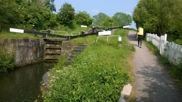
Then, continued down slope through a vineyard to the Stroud Canal. Level and straight it took us through locks and old cloth mills until it was time to back track up hill to the accommodation. A long slog in the heat to approximately half a mile from the Prince of Wales.
Still the chance to sample gourmet food in the restaurant and observe the disappointed faces of those in the bar watching Liverpool v Real Madrid.
Kate said “I thought this was going to be the easy day !”
